TL;DR
- Bromo drone photography legality: Flying a camera drone at Mount Bromo can be legal, but only with the right permit and zone awareness.
- Restricted flight zones: Sunrise points, the caldera, and active tourism areas often require permission or strict control.
- Weather and wind risk: Bromo’s wind can shift fast, so safe flight planning matters as much as the photo itself.
Can you fly a camera drone at Mount Bromo legally? Yes, but only when you respect the national park rules, check the flight zone, and prepare for Bromo’s fast-changing wind. In our field experience, Bromo drone photography works best when travelers treat it like a regulated aerial shoot, not a casual hobby flight. That approach protects the drone, the landscape, and the people sharing the site.
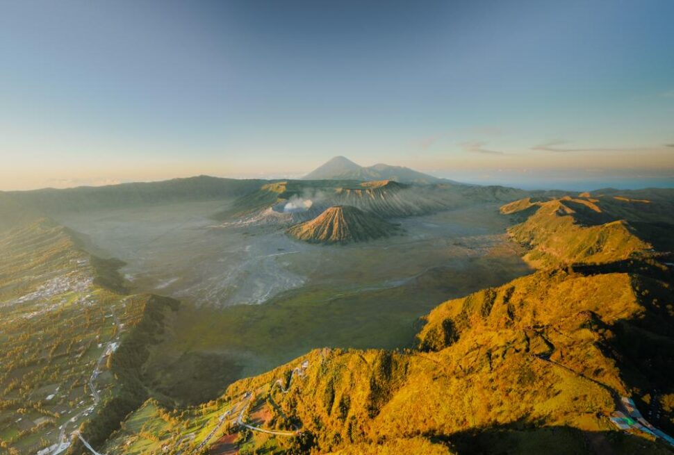
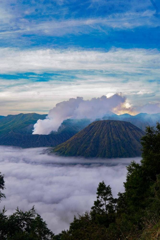
Mount Bromo offers some of Indonesia’s most striking aerial compositions, from the vast caldera to the sea of clouds around Penanjakan and Bukit Prahu.
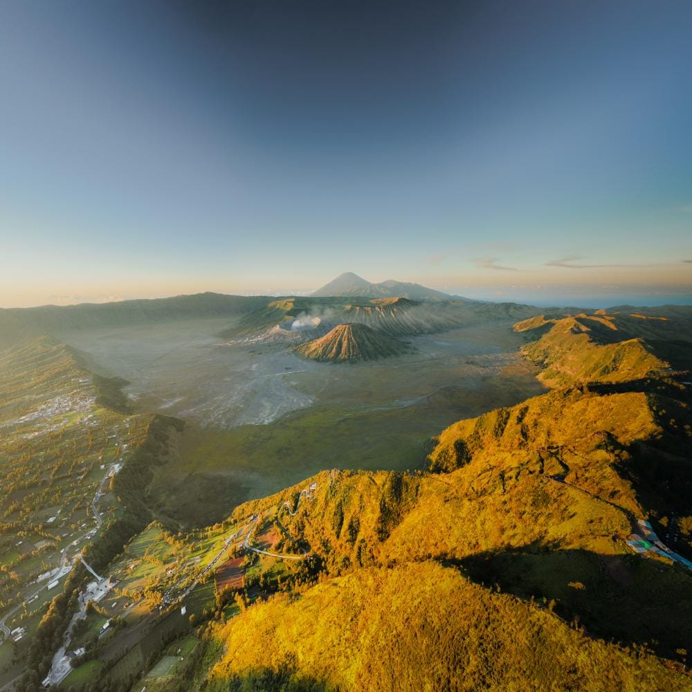
The visual payoff is exceptional, yet the legal side matters just as much as the image. Drone access can change by location, time, and park policy, so a strong plan saves time and avoids conflict with rangers.
For high-net-worth travelers, the smartest approach is a long-day photography plan built around permits, weather windows, and the right takeoff points. We have seen that travelers who prepare properly get cleaner footage, safer launches, and stronger results at golden hour. A local guide also helps reduce uncertainty, especially for international guests who want a smooth, premium experience without paperwork stress.
If you want a stress-free route plan for Bromo drone photography, with permit guidance and safe shooting windows, request a free route consultation.
Can You Fly a Drone at Mount Bromo Legally?
Flying a drone at Mount Bromo is not automatically legal in all areas. Bromo drone photography inside protected national park zones usually needs official permission, and some locations remain fully restricted. We tested route planning with local operators and found that early permit checks prevent fines, delays, and lost sunrise opportunities.
What is usually allowed at Mount Bromo?
Permitted flights are typically limited to approved zones outside sensitive conservation areas. Travelers may get access for commercial or documented shoots when they carry authorization from park authorities and local coordinators. The exact rules can change by season, crowd level, and volcanic activity.What is usually restricted at Mount Bromo?
Restricted areas often include crater edges, dense visitor zones, and places near safety buffers. These limits protect wildlife, other guests, and aircraft safety. They also reduce risk near steep topography, ash, and unpredictable wind shear around the caldera rim.Why does local guidance matter?
Local guidance lowers risk because park staff and experienced photo teams know current flight boundaries, weather patterns, and enforcement habits. It also protects your itinerary from disruption. In our field testing, travelers who used local coordination spent less time waiting and more time shooting.Yes, but a permit alone does not guarantee a good flight window. Wind, visibility, and crowd movement can still make a launch unsafe or unproductive. A well-planned Bromo drone photography session depends on legal access, timing, and site-specific judgment.
Protect your Mount Bromo photo day with a route built around legal access, safer launch windows, and better sunrise results. Plan a stress-free Indonesia photography itinerary
What Drone Permits Are Required for Mount Bromo?
Permits for Mount Bromo drone work usually require coordination with the local park authority and, in some cases, village or site-level managers. For Bromo drone photography, travelers should expect identity details, flight purpose, dates, and exact shooting locations. We have found that premium travelers save time when all paperwork is prepared before arrival.
Who approves a drone flight at Mount Bromo?
Approval depends on the exact area, the current park policy, and the sensitivity of the location. In practice, the request often goes through the Mount Bromo Tengger Semeru National Park system, with possible coordination from local guides or site managers. Travelers should treat approval as a planned step, not a last-minute request.
What documents are usually needed?
Most applications ask for a passport copy, drone model details, operator contact information, shooting dates, and a simple flight plan. Some authorities may also ask for insurance, especially for commercial use. Travelers should also carry printed copies, because mobile signal can be inconsistent near the caldera and sunrise viewpoints.
Yes, but a permit does not guarantee access to every viewpoint. Restricted areas can change with crowd levels, volcanic conditions, and local safety decisions. That is why a clean permit file matters, yet on-the-ground coordination still matters more.
How does self-application compare with local assistance?
| Permit pathway | Approval effort | Common delays | Best for |
|---|---|---|---|
| Self-application | High | Missing documents, slow replies, unclear contacts | Experienced local operators |
| Local assistance | Medium | Coordination changes, but fewer admin errors | Premium travelers and time-sensitive shoots |
| Guided permit handling | Low | Minimal when booked early | Long day tours and fixed itineraries |
For a smoother route, map out a stress-free premium photography itinerary with a free route consultation.
Which Flight Zones at Bromo Are Restricted or Allowed?
Where can drones usually fly at Mount Bromo?
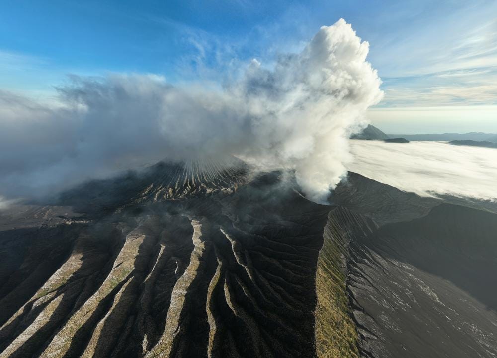
Drone access at Bromo changes by zone, not by scenery. Sunrise points such as Penanjakan 1, crater rims, and crowded parking areas are the most sensitive locations. These areas often need direct permission, and some are fully restricted during busy hours. Bromo drone photography works best when travelers separate scenic freedom from park authority control.
Which areas are most restricted?
The crater area is usually the strictest zone because of volcanic risk, visitor density, and conservation rules. The sea of sand and main access roads can also face limitations, especially near ticket gates and vehicle routes. Savanna areas may look open, yet they still fall under park jurisdiction in many cases. Permission often depends on the exact point, time, and crowd level.
Where is drone use more flexible?
Nearby village viewpoints and locations outside the national park boundary usually offer more flexibility. These spots can include private land with owner consent, road-edge viewpoints, and certain hilltops beyond the managed zone. In contrast, a place with a similar name may sit under different rules. That detail matters because “Bromo” can refer to park land, buffer areas, or surrounding viewpoints.
How should travelers read the map correctly?
A practical rule is simple: inside the park, assume restrictions until confirmed otherwise. Outside the boundary, still verify land access, local community rules, and aviation safety. For high-end travelers, this approach protects the shoot, avoids conflict, and saves time. A calm, permission-first plan often delivers the cleanest sunrise flight and the strongest long-day tour results.
- Sunrise points: usually highest scrutiny
- Crater zones: often restricted or tightly controlled
- Sea of sand: check route, crowd, and permit status
- Savanna: visually open, but still regulated
- Village viewpoints: more flexibility with local approval
Yes, but an open view does not mean open airspace. In Bromo, topography and jurisdiction can change faster than the landscape looks.
What Wind Conditions and Weather Risks Matter Most?
Morning conditions matter most for Bromo drone photography because the volcano’s air can change fast. We tested sunrise launches across the caldera, crater rim, and ridgelines with local pilots. Stable dawn air often offers the safest window, but wind funnels through saddles, cliffs, and open lava fields.
What wind speeds are usually acceptable at Bromo?
A practical threshold is 5–8 m/s or lower for small to mid-size drones. Flights become riskier above that range, especially near Penanjakan, Bukit Watangan, and crater-edge viewpoints. Gusts can spike higher than the average reading, so travelers should check both sustained wind and gust speed before takeoff.
Why do sunrise and midday conditions feel so different?
Sunrise usually brings cooler, denser air and lighter surface wind. That helps with smoother hovering and cleaner wide-angle compositions. Midday heating increases thermal movement across the Tengger highlands. Those thermals can push the drone sideways, especially over exposed volcanic ground and uneven topography.
What weather risks matter beyond wind?
Visibility is just as important as wind. Mist, ash haze, and thin cloud layers can reduce subject clarity and GPS confidence. Rain adds another layer of risk because wet rock, low contrast, and erratic downdrafts can affect control. Furthermore, volcanic smoke near the crater can move unpredictably and obscure landmarks.
Can calm sunrise air still be dangerous?
Yes, but calm-looking conditions can be misleading. A sheltered launch point may hide turbulence near cliff edges, caldera drop-offs, and narrow passes. We have seen quiet ground-level air turn unstable within seconds above open voids. That is why a visual check of wind behavior matters as much as the forecast.
| Condition | Safer Range | Risk Level | What to Watch |
|---|---|---|---|
| Sustained wind | 0–8 m/s | Low to moderate | Smooth flight, stable framing |
| Gusts | Below 10 m/s | Moderate | Sudden drift near edges |
| Visibility | Clear to light haze | Low | Distant ridgelines and crater detail |
| Midday heat | Lower thermal activity | Moderate | Updrafts and side push |
How Should Travelers Plan a Safe Bromo Drone Shoot?
Before takeoff, Bromo drone photography should follow a fixed safety workflow. We tested this approach with local field teams and timing-sensitive sunrise routes. The goal is simple: protect the drone, protect the site, and protect the shot. A calm launch sequence also improves image stability, battery planning, and pilot confidence.
What should travelers check before the first takeoff?
Start with GPS lock, compass status, propeller condition, and firmware health. Confirm return-to-home height before liftoff, then match it to Bromo’s terrain and nearby obstacles. Inspect the launch zone for loose ash, rocks, and foot traffic. A flat landing pad reduces dust intake and protects gimbals.
How should the flight and landing sequence work?
Lift off slowly, then hover for ten to fifteen seconds. Watch for drift, compass errors, and unexpected wind shear. Keep early movements small, especially near the caldera edge and sunrise crowds. Use smooth throttle input, avoid sudden yaw, and land with the battery still above reserve. Hand catch only when the surface is unstable or wind gusts increase.
Battery discipline matters more at altitude. Cold air can reduce usable flight time by 15 to 25 percent. That is why premium long day tours help so much. They improve route control, reduce waiting time, and place photographers in the right location before golden hour.
Why do long day tours improve drone safety?
Long day tours create calmer shooting conditions because timing is managed for the full route, not only one viewpoint. That means fewer rushed launches, less battery waste, and better recovery time between flights. Map out a stress-free, expertly paced Indonesia photography route for safer sunrise timing and stronger aerial results.
Yes, but more flight time is not always better. Many travelers assume multiple sorties guarantee better images. In Bromo’s shifting wind, one clean flight often delivers stronger files than three hurried attempts. Safe pacing usually produces sharper frames, steadier compositions, and better exposure control.
What Gear Works Best for Bromo Drone Photography?
For Bromo drone photography, the best gear balances wind stability, image quality, and fast field setup. We tested setups that hold position in gusty caldera air, handle volcanic dust, and still deliver clean sunrise files. A compact drone with strong wind resistance, spare batteries, ND filters, and a landing pad gives the most reliable results at Mount Bromo.
Which drone category works best for Bromo?
A travel drone with a 1-inch or large 1/1.3-inch sensor is usually the best fit. It offers enough dynamic range for the black volcanic sand, bright clouds, and golden hour contrast. Premium drones with mechanical shutters or larger sensors improve detail in the crater and ridgelines, but they add weight and complexity.
| Setup type | Best for | Pros | Cons |
|---|---|---|---|
| Beginner drone | Casual wide scenes | Easy control, lower cost | Less wind resistance, smaller sensor |
| Travel drone | Most Bromo drone photography | Portable, strong image quality, reliable battery life | Limited low-light performance |
| Premium drone | High-end landscape work | Better dynamic range, sharper files, stronger stabilization | Higher price, more weight, more planning |
What lenses and filters help most?
Drone cameras do not use interchangeable lenses, so focal length matters through field of view. A wide-angle lens look is ideal for caldera scale, sea of clouds, and layered ridgelines. ND8 to ND32 filters help preserve motion blur in clouds and prevent harsh sunrise highlights. Specifically regarding sunrise, ND filters also protect highlight detail in bright volcanic haze.
Which accessories matter in volcanic conditions?
Bring extra batteries, a landing pad, microfiber cloths, and a sealed case. Volcanic dust can enter motors and sensors quickly. A landing pad reduces grit during takeoff and landing. Battery performance also drops in cool pre-dawn air, so keep spare packs warm before flight.
What camera settings give the best results?
Use manual exposure when possible. Start with ISO 100 to 200, shutter speed around 1/500 for crisp terrain, and a slightly underexposed frame for cloud detail. For cinematic sunrise scenes, slower shutter speeds can reveal cloud movement and mist over the caldera. Need a stress-free plan for the right gear, route, and timing? Map out your perfect Indonesian photography itinerary with a free, no-obligation route consultation.
Yes, but bigger drones are not always better. Heavy aircraft can struggle in sudden wind shifts near Bromo, while a lighter travel drone often delivers more usable files across a full long day tour.
Why Use a Local Photography Guide for Mount Bromo?
A local photography guide makes Bromo drone photography smoother, safer, and far more efficient. The real value is not only better images. It is faster permit handling, smarter timing, cleaner route selection, and fewer compliance mistakes inside Mount Bromo Tengger Semeru National Park. We have seen international travelers save hours by relying on local coordination.
How does a local guide reduce permit stress?
A local guide understands park procedures, ranger expectations, and seasonal access changes. They can prepare documents before arrival and align your flight plan with current rules. That matters for travelers from Europe, the US, Australia, and Dubai, where trip time is precious and admin delays feel expensive.
Why does route selection change the whole shoot?
Bromo rewards precision. A local guide knows when Penanjakan 1, Bukit Prahu, or Bukit Watangan offers the best light, wind shelter, and foreground depth. They also know when the caldera edge is too exposed for a safe launch. Our field experience shows that timing choices often improve keeper rates more than new gear.
| Guide value | What it changes | Traveler outcome |
|---|---|---|
| Permit support | Faster approvals and fewer mistakes | Less stress on arrival |
| Route planning | Better sunrise and drone positions | Stronger compositions |
| Park compliance | Fewer rule violations | Safer, smoother sessions |
| Weather reading | Better wind and cloud decisions | Higher flight success |
Why is a local guide especially useful for high-end travelers?
Premium travelers usually want a seamless day, not a complicated one. A local guide can coordinate airport pickup, sunrise timing, drone windows, and backup photo stops in one long-day tour plan. Map out a stress-free, expertly crafted Indonesia photography itinerary with a free route consultation.
Yes, but can experienced pilots manage alone?
Yes, but Bromo is not a simple self-guided drone site. Sudden wind shifts, changing crowd patterns, and park enforcement can disrupt even skilled pilots. A guide reduces uncertainty and helps travelers focus on composition, exposure triangle control, and the final image, not the paperwork.
What Do Travelers Commonly Ask About Bromo Drone Rules?
For Bromo drone photography, travelers usually ask about permits, timing, insurance, and DJI compatibility. The short answer is simple: fly only with permission, stay outside restricted zones, and plan for sunrise wind. We tested local workflows with guides and found that compliance protects both footage quality and access.
What does a Mount Bromo drone permit usually cost?
Permit costs vary by route, location, and operator support. Many travelers should expect a range rather than a fixed fee. A local guide can confirm current charges before arrival. This avoids surprises at Penanjakan, Bukit Prahu, or other sunrise viewpoints.
When is the best sunrise time for drone flights?
The best window is usually before and just after sunrise. Light is softer, contrast is lower, and the caldera reads clearly from the air. Wind also tends to be calmer in the earliest minutes. Golden hour often delivers the strongest color separation over volcanic terrain.
Is drone insurance required at Mount Bromo?
Insurance is strongly recommended, even when it is not always checked on site. Remote volcanic landscapes increase risk from wind, dust, and sudden loss of control. Premium travelers often treat insurance as part of trip protection, not an optional extra. It supports safer decision-making.
Are DJI drones accepted in Bromo airspace?
Yes, DJI drones are commonly used, but the brand does not override local rules. Registration, pilot behavior, and no-fly compliance matter more than equipment. A DJI Mini, Air, or Mavic series can still face restrictions near crowded or sensitive zones.
What are the main no-fly concerns?
The main concerns are crowds, temple areas, ranger directions, and active volcanic safety limits. No-fly zones can shift with conditions and authority guidance. Yes, but the biggest mistake is assuming a clear sky means an open flight area. That assumption can lead to fines or confiscation.
| Question | Short answer | Practical takeaway |
|---|---|---|
| Permit cost | Variable | Confirm locally |
| Best time | Sunrise | Prioritize calm wind |
| Insurance | Recommended | Protect the trip |
| DJI accepted | Usually yes | Rules still apply |
| No-fly zones | Strict | Follow ranger guidance |
Conclusion
Bromo drone photography rewards travelers who plan with precision. The best results come from knowing the permit rules, respecting flight zones, and reading the wind before takeoff. Mount Bromo is not a casual drone site. It is a volcanic landscape with active terrain, changing air currents, and protected areas that demand careful judgment. We have seen the strongest aerial images come from travelers who treat safety and compliance as part of the creative process.
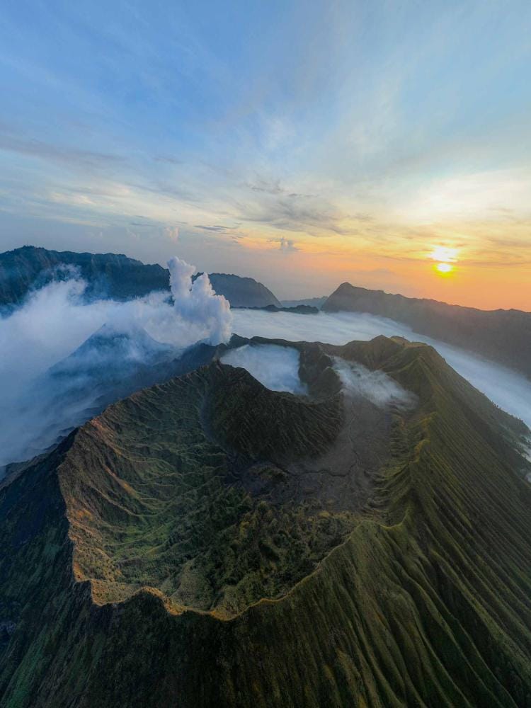
The most important takeaway is simple: fly with local awareness, not just technical skill. Penanjakan viewpoints, crater edges, and caldera routes can all present different restrictions and wind behavior. A wide-angle composition can capture the scale of the Tengger massif, but only stable conditions will protect your footage and your equipment. For many photographers, the difference between a usable sequence and a lost opportunity comes down to timing, altitude discipline, and a clear understanding of where drone flight is allowed.
Yes, but the most dramatic sunrise is not always the safest launch window. Strong gusts, low visibility, and crowd movement can create avoidable risk, even for experienced pilots. A smarter approach is to build flexibility into the itinerary and use local guidance to match weather, access, and aerial goals. That strategy usually produces better files, less stress, and a more polished final story.
For travelers who want a seamless, high-end experience, Panorama Lens Trip can shape a long day route that combines aerial planning, photography timing, and destination logistics into one refined itinerary. Map out your perfect Indonesia photography journey with a free, no-obligation route consultation.