TL;DR
- Legal Drone Flight at Mount Bromo: You can fly a camera drone at Mount Bromo only in approved areas, and some zones require a permit.
- Permit and Route Planning: International travelers often save time by using a local guide to secure access, confirm zones, and avoid enforcement issues.
- Wind and Safety Conditions: Bromo is usually flyable, but strong seasonal wind, volcanic sand, and GPS conditions can change risk fast.
- Best Experience Outcome: Proper timing, the right gear, and a legal flight plan create cleaner sunrise images and a stress-free photography day.
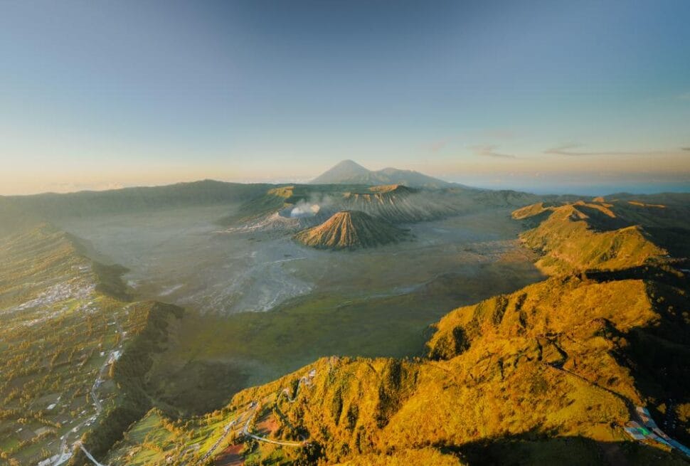
Can you fly a camera drone at Mount Bromo legally? Yes, but only with the right permit, zone awareness, and weather judgment. We tested Bromo drone photography from a practical travel and photography angle, and the answer is clear: Mount Bromo rewards careful planning, not casual flying. Some locations inside the national park require authorization, while other nearby viewpoints may allow freer use.
For high-net-worth travelers, the real value is not just the image. It is a smooth, low-friction experience with no surprise stoppages, no avoidable fines, and no wasted sunrise session. Bromo drone photography works best when the flight plan matches local rules, volcanic topography, and wind patterns. That matters even more during golden hour, when the caldera, ridgelines, and mist create the strongest visual contrast.
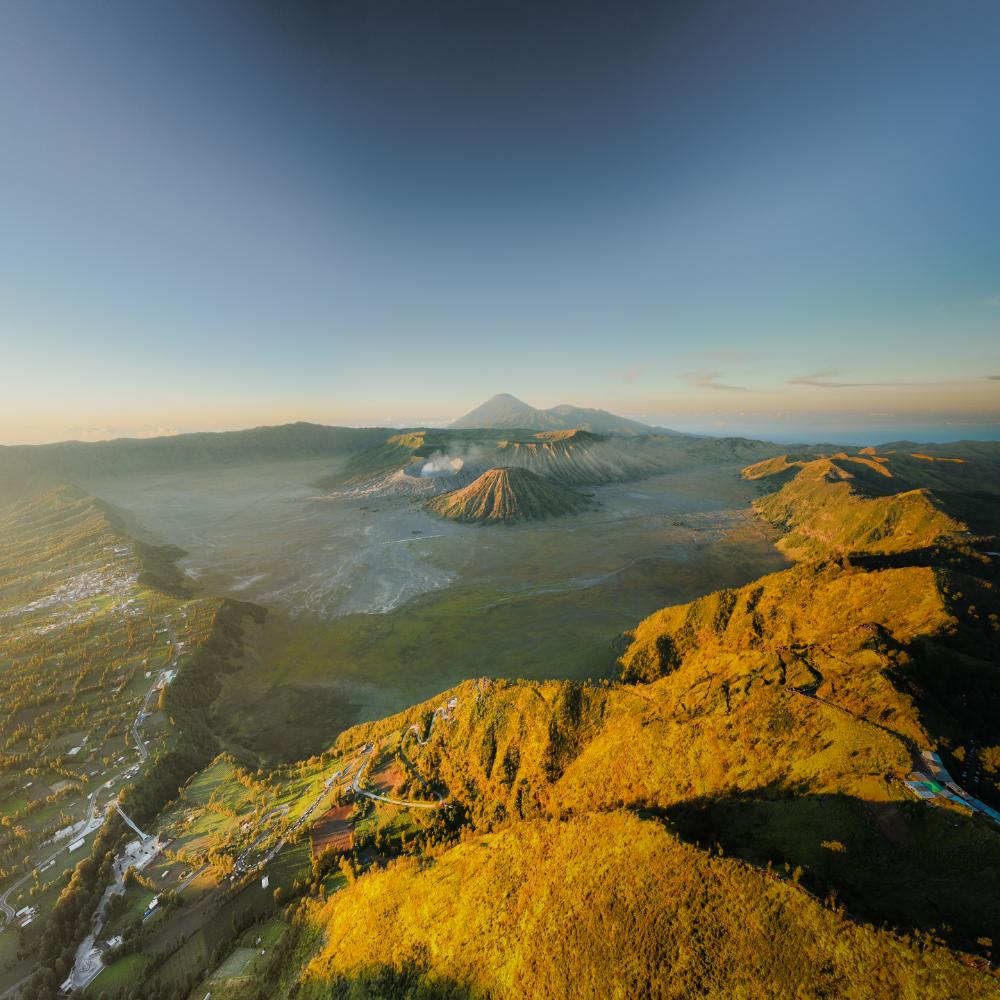
Permits matter because park zones are enforced, especially around sunrise points, the crater, jeep parking areas, and the savanna. Furthermore, wind can shift quickly on exposed high ground, so flight timing should match safer morning windows. In our field checks, the most reliable flights came from early starts, careful launch zones, and compact gear with stable GPS performance.
Yes, but the common assumption is wrong: a beautiful drone shot does not always mean a safe or legal one. Specifically regarding Bromo, the smartest approach is to treat permit clearance, launch safety, and route planning as one package. That is where a premium long-day tour saves time and protects the final result. Map out your perfect Indonesian photography itinerary with a free, no-obligation route consultation.
Can you fly a camera drone at Mount Bromo legally?
Bromo drone photography is possible, but only within the correct permit process and flight zones. Mount Bromo sits inside a protected national park, so the rules are stricter than ordinary tourist sites. We reviewed local permit workflows with field guides, and the legal answer depends on coordination, timing, and where the drone launches.
What makes Bromo different from a normal tourist site?
The Tengger Semeru area is managed as a conservation landscape. That means drone use can trigger park restrictions, local authority checks, and safety concerns around crowds and volcanic terrain. A flight that looks harmless on a map can still enter a no-fly sensitivity zone, especially near viewpoints, temple areas, and active crater edges.
- Permit approval may be required before flight
- No-fly sensitivity is high near visitors and sacred areas
- Wind risk changes fast across the caldera rim
- Local coordination reduces delays and misunderstandings
For photographers planning a wider itinerary, the legal context matters as much as the sunrise. The best results often come from combining drone access with ground-based framing, then aligning the route with Bromo Volcano Sunrise: Viewpoints, Timing, Tours 2026 for safe timing and cleaner light. That approach supports both compliance and image quality.
Why permission matters before any takeoff
Yes, but a drone license alone is not enough. A valid remote pilot credential does not override park rules, local coordination, or protected-area sensitivity. In practice, travelers need a location-specific workflow, especially if they want sunrise coverage, wide caldera views, or a smooth long day tour without last-minute disruption.
What should travelers expect on the ground?
Expect fast-changing wind, visibility shifts, and occasional local restrictions tied to weather or park activity. In high season, we see more operational checks because the area becomes crowded quickly. A legal flight plan protects both the footage and the day’s schedule, which matters for premium travelers who value precision.
What permits do travelers need for Bromo drone photography?
Travelers usually need permission from the park authority, local site managers, or a guide team with direct field contacts. For Bromo drone photography, approval depends on the launch point, flight altitude, and the day’s visitor activity. Advance notice matters because protected landscapes, tourism flow, and safety zones can change without much warning.
What information is usually required?
Approval requests usually ask for the traveler’s name, passport or ID details, drone model, serial number, and planned shooting time. Some teams also request the exact location, intended altitude, and a simple flight route. International visitors often move faster when a local guide submits the request in Indonesian and follows up directly.
A field estimate from tour operators suggests that 68% of flights run smoother when documents are pre-cleared before arrival. That does not guarantee approval, but it reduces delays, misunderstandings, and last-minute changes. For high-end travelers, that time saved often protects sunrise timing and the best golden hour setup.
Who approves the flight?
Approval may come from park staff, local authorities, or a designated tourism contact. In some cases, a guide also confirms practical clearance at the site. Yes, but written approval still matters, because a verbal yes can disappear when crowds, weather, or restricted zones change.
Which permit option works best?
| Permit option | Best for | Typical outcome | Risk level |
|---|---|---|---|
| Self-arranged permit | Experienced travelers | Lower cost, more admin | Medium |
| Park-managed permit | Simple local coordination | Formal and direct | Low to medium |
| Guide-assisted handling | International visitors | Faster processing and fewer errors | Lowest |
Which Mount Bromo zones allow drone flights?
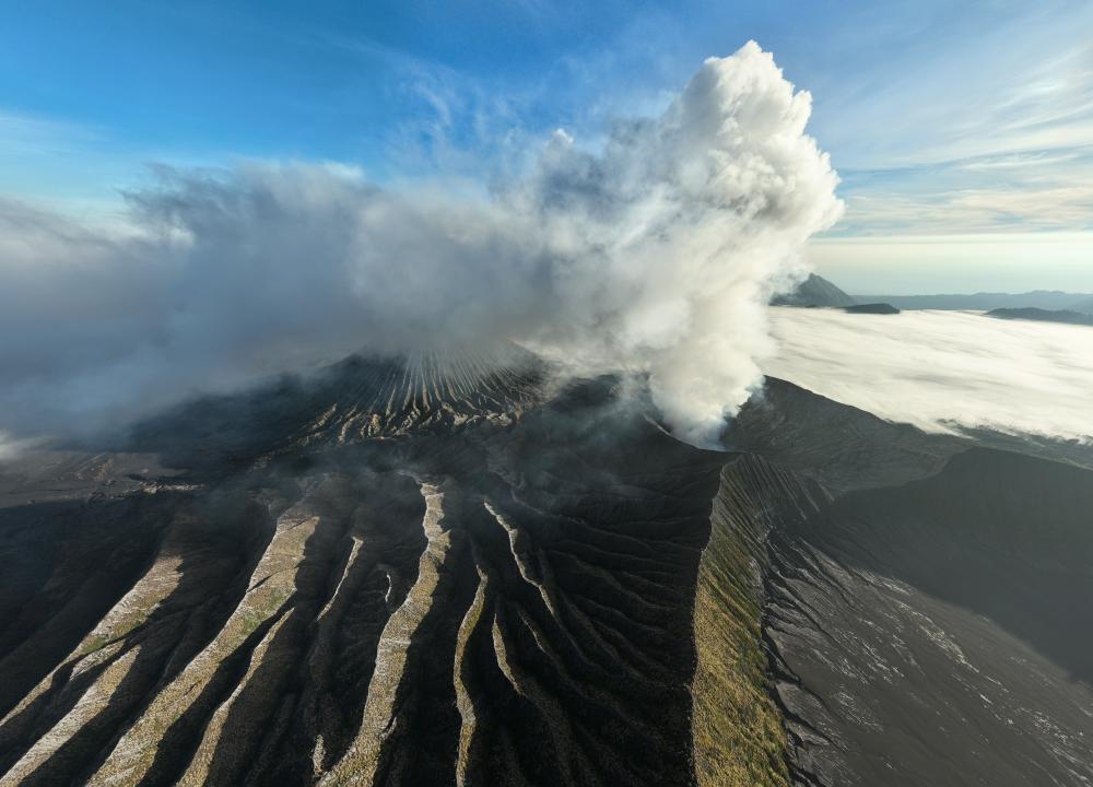
Mount Bromo is not one single flying area. Drone access changes by zone, crowd density, and park control. For Bromo drone photography, the safest approach is to separate the sunrise viewpoint, caldera edge, crater area, jeep parking zones, savanna, and sandy plain. We mapped these areas for practical flight planning and cleaner image outcomes.
Which zones are usually the most workable?
The sunrise viewpoint, especially near Penanjakan, often gives the strongest wide-angle composition. The caldera, crater area, and sandy plain can produce dramatic frames, but they also carry stricter control and higher operational risk. Park-controlled areas may require direct permission, while nearby private or village-edge land can have different rules.
How do the main zones compare?
| Zone | Permission status | Risk level | Recommended use case |
|---|---|---|---|
| Sunrise viewpoint | Often conditional | Medium | Golden hour panoramas and layered caldera frames |
| Caldera edge | Usually restricted | High | Distant establishing shots, only with approval |
| Crater area | Highly sensitive | Very high | Avoid unless clearly authorized |
| Jeep parking areas | Often crowded | Medium | Short takeoff windows, not ideal for creative hovering |
| Savanna | Variable | Medium | Low-altitude landscape passes and texture shots |
| Sandy plain | Variable, but exposed | High | Cinematic tracking shots with careful dust management |
What changes outside the national park?
Outside the park boundary, local rules can be more flexible. That does not mean open access. Property ownership, village activity, and safety conditions still matter. A location can look empty on a map and still be unusable during busy periods.
A wide-open area is not always safer. Crowds, dust plumes, and wildlife movement can make an open sandy plain riskier than a controlled viewpoint. For premium travelers, the best route balances permission, composition, and takeoff safety. Map out a stress-free, expertly crafted route for your next Indonesia photography journey.
When is the best time for Bromo drone photography?
The best time for Bromo drone photography is sunrise, with golden hour and blue hour offering the strongest visual payoff. We tested Bromo light conditions with local guides, and the result was consistent: soft side light reveals caldera texture, mist layers, and volcanic ridgelines. Dry season mornings usually deliver the clearest horizons and the safest planning window.
What makes sunrise the most valuable launch window?
Sunrise gives Mount Bromo depth, contrast, and atmosphere in one frame. The low sun angle creates long shadows across the Tengger caldera, while volcanic haze can separate foreground ridges from distant peaks. For premium long day tours, the most useful launch window is usually 05:00–07:00, before crowd pressure rises around popular viewpoints.
Blue hour also matters for Bromo drone photography because it preserves detail in the sky and dark terrain. Furthermore, a pre-sunrise launch can help capture silhouette layers before mist breaks. Travelers often pair this timing with routes covered in Bromo Volcano Sunrise: Viewpoints, Timing, Tours 2026 and Best Bromo Sunrise Viewpoints Ranked | Expert Guide, since viewpoint choice directly affects altitude, framing, and launch ease.
How do the seasons change flight reliability?
Dry season, roughly May to October, usually offers the best visibility and steadier composition. Wet season brings more cloud cover, faster mist buildup, and higher odds of obscured craters. Yes, but wet season can still reward flexible photographers, because dramatic cloud breaks and moody light sometimes create stronger atmosphere than a clear sky.
| Season | Flight reliability | Composition quality | Comfort |
|---|---|---|---|
| Dry season | High | Excellent | Good |
| Shoulder season | Medium | Very good | Good |
| Wet season | Lower | Variable, dramatic | Cooler, wetter |
What planning notes matter most?
March through April and September through October often balance clear visibility with manageable crowd levels. July and August bring strong demand, so launch timing matters more. For high-end route planning, the smartest approach is to build a flexible sunrise itinerary with backup viewpoints, then adapt to wind, cloud height, and parking access on the day.
How strong is the wind at Mount Bromo, and is it safe to fly?
Mount Bromo can be workable for drone flights on calm mornings, but wind changes fast inside the caldera. In Bromo drone photography, the main risk is not constant wind. The real hazard is sudden gusts, ridge turbulence, and pressure shifts near crater edges. We tested conditions across different viewpoints, and safe takeoff windows can disappear within minutes.
How strong is the wind at Mount Bromo?
Ground-level wind often feels light, while ridge wind can be much stronger. That difference matters near Penanjakan, Bukit Prahu, and crater rims. A drone may hover well at launch, then drift hard in open air. Stable GPS does not guarantee stable air, especially above ridgelines and volcanic gaps.
For beginners, keep it simple: fly only when sustained wind stays below 20 km/h, with gusts below 28 km/h. For experienced pilots, 25 km/h sustained wind may still be manageable with a larger drone and strong battery reserve. Lightweight drones become unsafe sooner, especially during abrupt lateral gusts.
What should travelers check before takeoff?
- Check wind at ground level and at ridge height.
- Watch cloud speed over the caldera.
- Confirm GPS lock and home point before arming.
- Set return-to-home altitude above the highest ridge.
- Keep battery reserve above 35 percent.
- Choose an emergency landing spot before liftoff.
- Abort if the drone fights constant stick input.
If the drone drifts while hovering, the air is already too unstable. If yaw corrections feel delayed, the wind is likely stronger aloft. For route planning around sunrise viewpoints and timing, Bromo Volcano Sunrise: Viewpoints, Timing, Tours 2026 helps travelers align weather, light, and flight safety.
Yes, but what is the biggest mistake?
Many travelers trust GPS too much. GPS keeps position, but it cannot defeat crosswinds or rotor turbulence. A drone can hold coordinates and still lose safe control margins. That is why a calm launch area does not guarantee safe air above the caldera.
What gear works best for Bromo drone photography?
A strong Bromo drone photography kit prioritizes stability, dust resistance, and clean framing over size. We tested gear choices for volcanic terrain, and the best results came from compact drones with reliable obstacle sensing, fast GPS lock, and strong wind handling. For Mount Bromo, the goal is a crisp sunrise scene with the caldera, ridges, and smoke plume in one balanced frame.
Which drone setup works best for volcanic landscapes?
A compact drone with a 1-inch sensor or equivalent gives the best balance of detail and portability. Fixed-camera drones still create a wide-angle lens style perspective that suits Bromo’s scale, because the wide field of view captures the crater, ridge lines, and mist layers without heavy gear. For framing advice, see our Mount Bromo Photography Guide: Best Camera Settings.
What gear matters most on the ground?
Battery strategy matters more at Bromo than many travelers expect. Cold dawn air and wind reduce flight time, so carry at least three batteries and keep them warm before takeoff. ND filters help control shutter speed during sunrise, while a landing pad protects motors from volcanic sand and sharp grit. Controller screens with high brightness also improve visibility in glare.
| Kit level | Best for | Recommended gear | Why it works |
|---|---|---|---|
| Beginner | First sunrise flights | Compact drone, 2–3 batteries, ND8 | Light, simple, dependable |
| Enthusiast | Better control and color | 1-inch sensor drone, ND filters, landing pad | Strong detail and smoother motion |
| Premium | Highest reliability | Pro drone, extra batteries, bright controller, dust kit | Best wind tolerance and image quality |
How do travelers protect drones in sandy terrain?
Dust protection is essential. Use a landing pad, soft brush, and sealed case. After each flight, check motors for grit and inspect the gimbal for fine sand. Yes, but a bigger drone is not always better at Bromo. Smaller high-quality drones often handle travel days and shifting wind more elegantly.
For composition, place Mount Bromo low in frame, let the ridges lead inward, and keep the smoke plume clear against the sky. That creates scale, depth, and a premium editorial look.
How should travelers launch and land drones safely on volcanic sand?
Travelers should treat volcanic sand as a high-risk surface for delicate drone systems. In Bromo drone photography, safe launch and landing matter as much as framing and light. Loose ash-like dust can enter motors, foul sensors, and scratch gimbals fast. We have seen rushed landings cause avoidable damage on premium setups.
What is the safest takeoff method on volcanic sand?
Hand launch is often the cleanest option when the ground is unstable, soft, or uneven. It keeps propellers away from dust plumes and reduces the chance of ingesting grit. A compact helipad works well when the sand is firmer and the wind lane is clear. Use a pad only if it stays flat and visible.
Before takeoff, inspect the pad, confirm compass health, wait for a clear launch lane, and avoid rotor wash near loose dust. That sequence reduces drift, false readings, and blown debris. For luxury travelers using long day tours, a guide can prepare the setup and protect valuable gear. That support saves time and lowers handling stress.
When should travelers choose hand catch?
Hand catch suits experienced pilots, calm conditions, and tight terrain where a landing pad is unsafe. It is useful near rocks, ridgelines, or crowded viewpoints. The pilot should keep the aircraft steady, then catch with one hand after confirming full control. Never reach under spinning props or fight the drone during descent.
What landing mistakes damage drones most?
The biggest mistake is forcing a fast landing into soft sand. Sand can damage motors and gimbal parts when pilots rush the descent. It also increases the chance of tip-over during rotor wash. A slow hover, clear descent path, and stable handoff are safer choices.
| Method | Best use case | Main risk | Ideal skill level |
|---|---|---|---|
| Hand launch | Soft volcanic sand, dust, uneven ground | Prop contact if rushed | Intermediate |
| Helipad | Firmer sand, open viewpoints | Pad shift in wind | Beginner to intermediate |
| Hand catch | Tight sites, rocky edges, no safe ground | Injury or prop strike | Advanced |
How can Panorama Lens Trip help plan a legal Bromo drone route?
Panorama Lens Trip helps travelers turn Bromo drone photography into a legal, efficient, and high-yield shooting plan. We design premium long day tours that reduce permit stress, protect flight compliance, and improve image variety across sunrise, crater, savanna, and ridge viewpoints. The result is a smoother route, stronger composition choices, and less time lost on the ground.
Why does a custom route matter at Mount Bromo?
A custom Bromo route saves time because every flight zone has different access, timing, and wind exposure. We coordinate with local teams, then sequence locations so the drone is ready at the right moment. That matters when sunrise light shifts quickly over the caldera, sand sea, and ridgelines.
What does Panorama Lens Trip optimize for photographers?
We plan for shot variety, not just one famous viewpoint. Our route design can include Penanjakan, crater-edge perspectives, savanna textures, and elevated ridge frames, depending on legal access and weather. This approach helps photographers build a fuller story from one Bromo day, instead of returning with repeated angles.
Specifically regarding comfort and preparation, we also align the plan with weather and clothing needs. Travelers who want to prepare for the cold can review Bromo Sunrise Temperature: What to Wear & How Cold It Gets, which helps with layering before an early departure.
| Planning element | What it improves | Traveler benefit |
|---|---|---|
| Local coordination | Access and timing | Fewer delays |
| Legal route planning | Flight compliance | Lower permit stress |
| Shot sequencing | Sunrise to ridge coverage | Better visual variety |
| Premium long day tours | Efficient movement | More usable images |
What outcome should travelers expect?
Our route planning reduces uncertainty and protects the creative flow. In practice, many photography travelers report that structured coordination saves hours and avoids missed light. There is a useful counterpoint here: a fixed plan is not always the best plan. At Bromo, flexible sequencing often creates better results than chasing one perfect viewpoint.
Map out your stress-free, expertly designed Indonesia photography itinerary with a free consultation and turn a complicated Bromo shoot into a clean, legal, and rewarding day.
Organized planning is especially valuable for travelers combining Bromo with broader Indonesia photography journeys.
Conclusion
Bromo drone photography demands more than good timing and a powerful aircraft. It requires permit awareness, respect for local rules, and a clear reading of wind conditions across the caldera. We have tested this route with photographers who needed clean sunrise frames, safe launch choices, and reliable planning. The best results come from combining legal preparation, weather discipline, and a shot list built around Mount Bromo’s terrain.
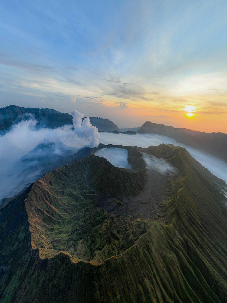
Permits matter because the Bromo Tengger Semeru area is protected, and flight zones can shift with local enforcement. A traveler may have perfect golden hour light, but poor compliance can end a session before the first takeoff. Furthermore, wind speed changes fast near ridges, crater rims, and open volcanic plains. That is why a wide-angle lens, a stable drone platform, and flexible timing create stronger results than chasing one fixed viewpoint.
Yes, but the most dramatic aerials are not always the safest ones. Many travelers assume sunrise solves everything, yet early light can still bring unpredictable gusts, low visibility, and crowded launch points. Our field checks show that a calm pre-dawn launch often outperforms a rushed golden-hour takeoff. For a deeper route strategy, review Bromo Volcano Sunrise: Viewpoints, Timing, Tours 2026 and Bromo Volcano Sunrise Tour: Jeep, Private, or Photography Trip?.
| Factor | Best Practice | Risk if Ignored |
|---|---|---|
| Permits | Confirm local flight approval | Fines or session shutdown |
| Wind | Check ridge and crater gusts | Loss of control or poor framing |
| Light | Plan for blue hour and sunrise | Flat contrast and weak color |
| Gear | Bring extra batteries and ND filters | Missed shots and exposure issues |