TL;DR
- Reported November 5 activity: The supplied account describes an increase at Mount Bromo, but a six-year interval should not be treated as a forecast.
- Monitoring and verification: Check current PVMBG updates and park notices before relying on reports, images, or historical comparisons.
- Visitor safety: Follow official access limits around the crater; conditions and restrictions can change quickly.
Mount Bromo’s reported activity on November 5, 2026, raises two important questions: what happened, and can its timing be predicted? The supplied account describes the event as an irregular increase and compares it with activity reported in 2019. That comparison alone does not establish a dependable eruption cycle.
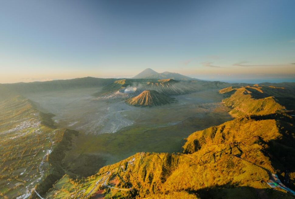
We examine what the report says, what monitoring evidence can support, and which claims need confirmation from Indonesia’s Geological Agency, including PVMBG. Bromo is an active volcano, so its conditions can change without offering visitors a reliable schedule. Travelers should verify current alert levels and access rules before setting out. For practical sunrise planning, see Bromo Volcano Sunrise: Viewpoints, Timing, Tours 2026.
The account also mentions a one-kilometer safety distance. Treat that figure as a reported restriction, not a permanent rule; follow the latest official instructions at the time of travel. A carefully planned long-day itinerary can make changing conditions easier to manage. Explore a tailored Indonesian photography itinerary with a stress-free planning conversation.
What happened at Mount Bromo on November 5, 2026?
Reports of increased activity at the bromo volcano on November 5, 2026, require confirmation through current Indonesian monitoring updates. The information available for this report describes an increase but provides no verifiable bulletin, alert level, or measured event details. Mount Bromo is an active volcano, so travelers should check official advice before visiting.
We are treating the reported date cautiously rather than presenting the activity change as confirmed. An official update from Indonesia’s Geological Agency, including its MAGMA Indonesia monitoring portal, would help establish what happened and whether authorities changed access rules. Local park and emergency services may also issue visitor guidance.
This article explains how Bromo’s activity intervals are assessed, what “variatic eruption” may mean, and which monitoring evidence matters. It also covers eruption terminology, reported causes, visitor restrictions, photography precautions, and ways to follow reliable updates.
An increase in reported activity does not automatically mean an eruption occurred or that every viewpoint is unsafe. Volcanic conditions can change quickly, however, and restrictions may apply to specific areas. Travelers should follow current official instructions, maintain distance from restricted zones, and avoid relying on old travel posts or unverified social media claims.
Does the Bromo volcano follow a predictable activity interval?
No. The bromo volcano does not follow a reliable, fixed eruption schedule. Reported intervals describe past observations, not a forecast. They cannot show when activity will increase or whether a particular travel date is safe. Visitors should rely on current official alerts and restrictions.
Some reference material cites intervals of two, four, six, and ten years. It also describes increased activity in November 2026 as a six-year interval after activity in 2019. Treat these figures as claims requiring verification against dated PVMBG records.
Intervals can change depending on how “activity” is defined, which years are studied, and how complete historical records are. A recurring observation is not evidence of a predictable cycle. Even a verified interval cannot forecast an impending eruption or establish a safe visit date.
| Reported claim | Evidence needed for verification | What visitors should do |
|---|---|---|
| Two-, four-, or ten-year intervals | Dated PVMBG records and a consistent definition of activity | Do not use these figures to plan travel |
| Six-year interval from 2019 to November 2026 | Confirmed dates and comparable activity measurements | Check current official alerts before visiting |
| Repeated activity at intervals | A complete record covering the stated period | Follow active restrictions, not historical patterns |
What does “variatic eruption” mean, and is it an official term?
“Variatic eruption” is not a standard volcanological term with a settled meaning. If a report uses it for a sudden increase in activity at the bromo volcano, readers should treat that wording as an interpretation until a qualified volcanologist or official bulletin confirms it.
Volcanic unrest describes changes from a volcano’s usual behavior, such as shifts in earthquakes, gas emissions, or ground movement. Unrest does not necessarily mean an eruption will follow. An explosion is a sudden release of material or energy, while a phreatic eruption is a steam-driven event involving heated water and existing rock. These terms are not interchangeable, and the available evidence must support any specific classification.
How should reports of sudden activity be interpreted?
Activity can appear sudden to observers even when instruments recorded changes beforehand. However, monitoring cannot guarantee advance warning of every event, and signals may be unclear or difficult to interpret. The absence of a reported warning does not, by itself, establish that no measurable signals existed.
For the reported November 5 activity, separate confirmed observations from explanations about its cause or type. Check the original bulletin, including its date, issuing agency, alert level, and exact terminology. In Indonesia, official information from the Center for Volcanology and Geological Hazard Mitigation (PVMBG) should take priority over informal labels. Do not call the event phreatic, explosive, or another eruption type without supporting evidence.
What monitoring evidence can confirm a change in Bromo’s activity?
A reliable assessment of the bromo volcano combines official observations with instrument data; one image or eyewitness report cannot confirm a change in activity. Indonesia’s Geological Agency and its Center for Volcanology and Geological Hazard Mitigation (PVMBG) provide technical interpretation when their published bulletins address an event.
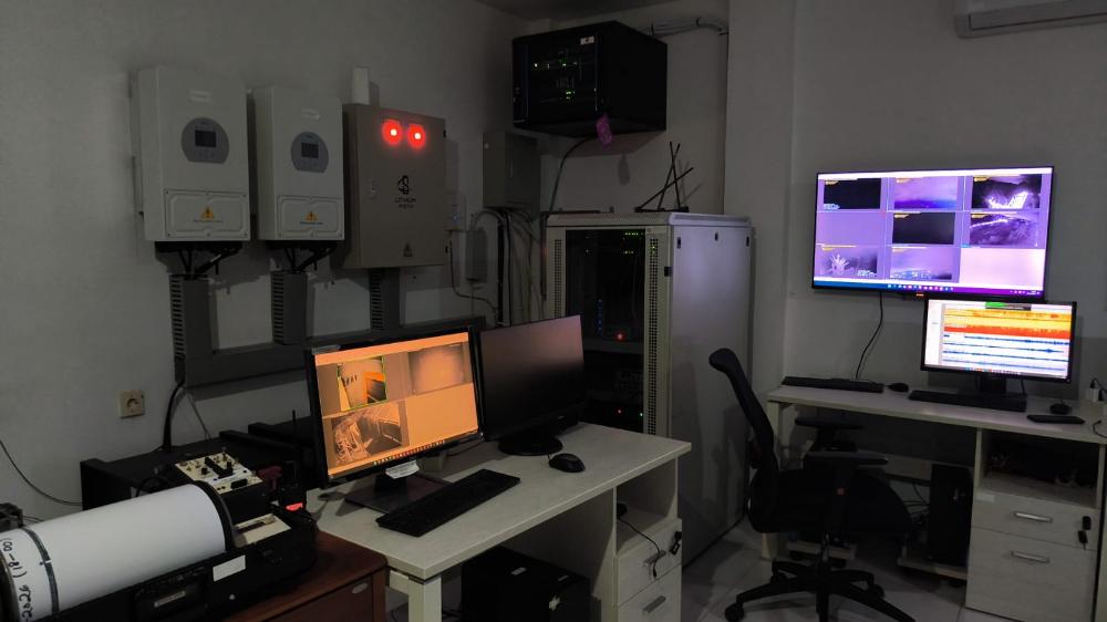
Evidence may include earthquake frequency and type, crater observations, gas measurements, ash emissions, and changes to the official alert status. Not every dataset is published for every event, so missing measurements do not prove that activity remained unchanged. The monitoring-equipment image is illustrative; it does not verify a specific reading from November 5, 2026.
When checking a report, note its publication date, observation period, measurement units, and any stated uncertainty. Compare updates from the same official source where possible, since instruments and reporting methods can differ. A bulletin may describe observations without establishing a cause or predicting what happens next.
Conditions also affect photography plans. Review Bromo sunrise temperatures and what to wear before setting out, and follow current access guidance.
Feel confident planning a carefully timed Indonesian photography itinerary with expert guidance.
How should readers understand Bromo’s eruption style and reported causes?
Mount Bromo is an active volcano, but no specific eruption style or cause can be assigned to the reported November 5, 2026 activity without authoritative evidence. Descriptions of Strombolian activity and a crater-rim landslide remain claims requiring confirmation. Check updates from Indonesia’s geological authorities before treating either explanation as established.
Strombolian activity generally involves intermittent explosive bursts that eject gas, ash, or volcanic fragments. Its intensity and frequency can change, so the label alone does not verify what occurred on a particular date. Ash, sand, or other ejecta should be mentioned only when a reliable source reports them.
A proposed landslide at Bromo’s crater rim also needs independent confirmation. Likewise, Mount Semeru’s proximity to Bromo, or activity at both volcanoes around the same time, does not prove that one triggered the other. Establishing a connection requires geological evidence, not timing alone.
For viewpoint context, see this guide to Bromo sunrise viewpoints. Viewpoint access and safe distances can change with official advisories.
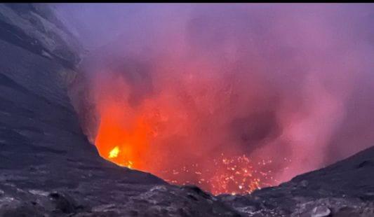
Illustrative image: Glowing orange volcanic activity and ash rising from Mount Bromo’s crater. This image does not document the reported November 5, 2026 event.
What visitor restrictions and safety steps apply near Mount Bromo?
Visitors near Mount Bromo should follow the latest instructions from park officials and Indonesian volcanic authorities. The bromo volcano’s access rules can change with alert levels, observed conditions, and official orders. Do not rely on an old distance, online itinerary, tour booking, or previous visit to judge whether an area is safe.
The one-kilometre exclusion distance cited in some reports cannot be confirmed here as the rule in force on November 5, 2026, or today. Check current notices from the Bromo Tengger Semeru National Park authority and Indonesia’s volcanology agency before departure. Follow the restrictions stated in those notices, even if they differ from older guidance.
What safety steps should visitors take?
Use this checklist before and during your visit:
- Check official activity and access updates immediately before travel.
- Obey barriers, posted notices, and instructions from park staff.
- Keep away from restricted crater areas and closed routes.
- Allow flexibility in transport, accommodation, and photography plans.
- Leave promptly if officials direct visitors to move.
A striking photograph or a confirmed tour does not establish that access is safe. Conditions can change, and restrictions may be introduced or revised at short notice. Enjoy a smoother Indonesian long-day tour with a route shaped around current conditions and your photography priorities.
How can photographers prepare for Bromo’s changing conditions?
Photographers preparing for the Bromo volcano should plan for changing light, wind, volcanic dust, and access limits. Keep safety ahead of any shot, and follow current park instructions rather than approaching restricted areas. Confirm sunrise access, transport timing, and weather with local operators and official sources before departure.
Pack equipment that supports flexible, distant shooting:
- A wide-angle lens for caldera views and a longer focal length for details from permitted viewpoints.
- Spare batteries, lens cloths, and a sealed bag or dust cover to protect equipment.
- A secure camera strap and only the gear needed for the planned route.
Adjust the exposure triangle as conditions shift. In low light, raise ISO or use a slower shutter speed when the camera is stable. Bright ash can fool the meter, so review the histogram and protect highlights. Wind can make tripods unstable and volcanic dust can affect lenses; change settings or locations only where access is allowed.
Respect local communities, sacred places, park rules, and other visitors. Avoid blocking viewpoints, disturbing ceremonies, or photographing people without permission. Our local planning can help align photography goals with safe transport and changing conditions. Build a more rewarding Indonesia photography journey with expert support across destinations and changing travel conditions
What should travelers know about Bromo activity updates?
Can Bromo’s activity be predicted by a six-year interval?
No. A pattern observed in past activity does not establish a dependable six-year forecast. Volcanic systems change, and monitoring evidence—not calendar intervals—should guide risk assessments.
Where can I check the current status?
Check current notices from MAGMA Indonesia and Bromo Tengger Semeru National Park. Confirm that each notice is current and check its publication date before traveling. Official alerts and park instructions may change quickly.
Is the one-kilometre restriction still in force?
Restrictions are time-sensitive. Do not assume a one-kilometre limit remains active or has been lifted. Confirm the latest exclusion zone with official Indonesian volcanic and park updates before approaching the crater.
Did Mount Semeru cause Bromo’s reported activity?
That claim requires scientific evidence. Similar timing or visible ash does not prove one volcano caused activity at another. Rely on findings from qualified monitoring authorities, not unsupported online claims.
Can visitors photograph an active crater?
Photography is appropriate only from areas permitted under current instructions. Stay outside restricted zones, follow park guidance, and stop shooting if conditions or authorities indicate a risk.
For a carefully planned long-day photography experience, find a route that balances memorable images with clear logistics and peace of mind.
The key point is simple: verify bromo volcano activity claims, and prioritize official guidance over schedules, assumptions, or social media.
Conclusion
The November 5, 2026, activity highlights why the bromo volcano must be treated as an active system, not a predictable photo backdrop. Intermittent activity and changing eruption behavior can alter conditions quickly around the crater. Travelers should check current Indonesian authorities’ advisories before departure and follow all access restrictions.
For photographers, safety and reliable information come before timing, equipment, or composition. Keep outside restricted zones, follow local guidance, and avoid approaching the crater for a closer view. Volcanic activity, wind, and visibility can change rapidly, so plans should remain flexible. The Mount Bromo Photography Guide: Best Camera Settings can help photographers prepare for changing light without compromising safe practices.
A compelling Bromo experience does not depend on witnessing an eruption. Sunrise, caldera views, and surrounding landscapes can still create meaningful photographic opportunities when conditions permit. Choose experienced local support, allow time for route changes, and prioritize official updates over unverified social media claims. Panorama Lens Trip can help shape a considered Indonesia photography itinerary around your interests, schedule, and comfort. Plan a seamless, expertly tailored photography journey across Indonesia with personalized guidance from Panorama Lens Trip.