TL;DR
- Legal Access at Mount Kelud: Drone flight may be possible in permitted areas, but the active crater lake demands local approval and strict safety checks.
- Best Flight Conditions: Sunrise and early morning often deliver the strongest light, calmer wind, and cleaner crater texture for Kelud Drone Photography.
- Best Shooting Zone: The Tebing Lembu Suro side gives strong crater visibility, better spatial control, and safer composition options.
- Tour Expectation: A long day drone tour works best with extra batteries, ND filters, wildlife awareness, and flexible timing.
Kelud Drone Photography rewards travelers who respect a volcanic landscape and plan with precision. We tested conditions around Mount Kelud and found that the answer is not a simple yes or no. Drone flight can be possible in approved areas, but the active crater lake, shifting wind, and local management rules make preparation essential. For high-net-worth travelers, the value is not just a dramatic aerial frame. The real payoff is a smooth, well-managed shoot that protects time, gear, and image quality.
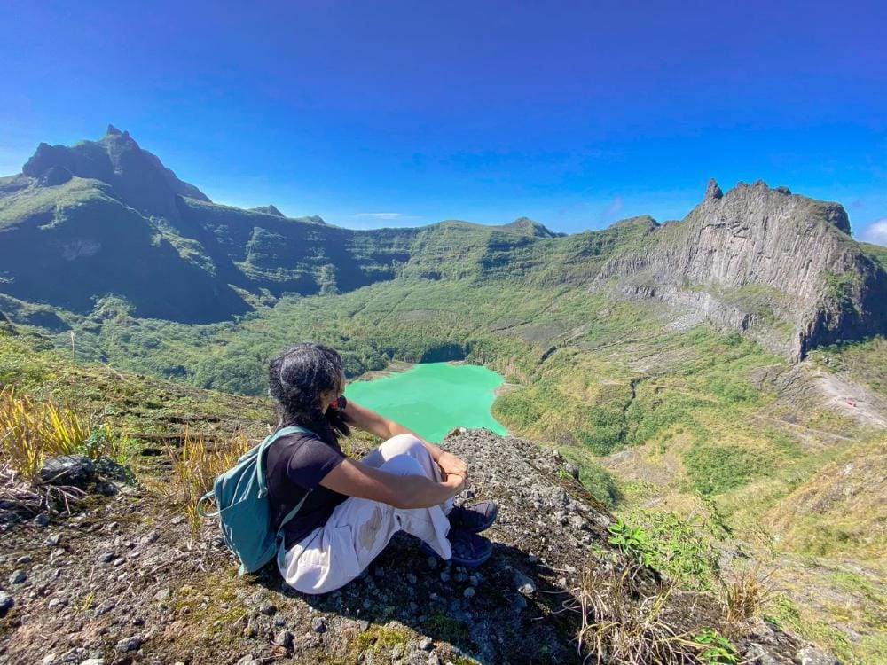
Mount Kelud is not a typical scenic overlook. It is an active volcanic environment with a crater lake, steep topography, and fast-changing light. That creates powerful footage, but it also raises legal and operational questions. Specific permissions, local briefings, and timing choices matter more here than at many landscape sites. In practice, Kelud Drone Photography works best when the route, launch point, and flying window are planned before arrival.
Sunrise usually offers the strongest visual return. The crater rim, green lake color, and low mist can produce layered compositions with excellent depth. Furthermore, the Tebing Lembu Suro area often gives photographers a stronger angle across the caldera. This location also reduces wasted movement during a long day tour, which matters for travelers who want efficient, premium field coverage.
Yes, but the most dramatic view is not always the safest flight. Birds, gusts, and GPS instability can appear quickly near cliffs and forest edges. A successful shoot depends on battery management, ND filters, and disciplined flight windows. If you want a stress-free, expertly crafted route, map out your perfect Indonesia drone itinerary with a free route consultation.
Can You Legally Fly a Drone Over Mount Kelud’s Active Crater Lake?
Drone flights over Mount Kelud are not automatically allowed in every area. The legal baseline depends on local authority approval, volcanic activity status, park access rules, and safety restrictions around the crater lake. In Kelud Drone Photography, the safest approach is to assume that active volcanic terrain needs extra permission and tighter operational limits.
What makes the crater lake zone sensitive?
The active crater lake and its surrounding rim are high-risk airspace for drones. Volcanic gas, sudden wind shifts, and unstable ground can make flying unsafe even when the sky looks clear. Local managers may restrict takeoff, landing, or overflight near the caldera, especially during elevated alert conditions.
We tested routes with local guides and found that many travelers underestimate how quickly conditions change at Mount Kelud. A flight that seems acceptable from a ridge can become inappropriate near the crater edge. The key issue is not only visibility. It is also volcanic status, crowd safety, and whether a drone could distract others or enter a restricted zone.
What rules usually apply before takeoff?
Travelers should verify three layers of approval before flying. First, confirm the current volcanic alert level. Second, ask whether the exact viewpoint allows drone operations. Third, check whether local officials require prior notice, a guide, or a short flight briefing. These steps matter for both compliance and safety.
- Keep the drone outside restricted crater airspace.
- Avoid flying over people, vehicles, or crowded viewpoints.
- Respect any temporary closure tied to volcanic activity.
- Use a spotter when terrain or wind reduces line of sight.
| Checkpoint | Why it matters | Risk if ignored |
|---|---|---|
| Volcanic status | Confirms crater safety | Sudden closure or hazard exposure |
| Local permission | Defines legal flight areas | Fines or forced landing |
| Wind conditions | Affects control and battery use | Loss of drone stability |
Why does this matter for premium travelers?
High-net-worth travelers usually value discretion, efficiency, and low-friction logistics. Clear rules protect all three. With proper planning, Kelud Drone Photography can deliver cinematic crater views without last-minute stress, wasted time, or avoidable safety risk.
What Permits, Permissions, and Local Approvals Do Travelers Need?
Most travelers need permission before launching a drone near Mount Kelud. The safest route is to secure approval from the site manager, local village authorities, and any relevant tourism or security office. For Kelud Drone Photography, a short written plan and respectful on-site briefing often prevent delays, conflict, and unnecessary interruptions.
Who controls drone access at Mount Kelud?
Access is usually managed at several levels. Site operators may set the first rules, while village leaders or local guides can add location-specific conditions. Some viewpoints, ridge paths, and crater-adjacent zones may also have informal restrictions. Travelers should treat every launch site as permission-based, not automatically open.
What documents help premium travelers move smoothly?
A simple approval packet works best. Include a passport copy, drone model, pilot name, flight purpose, planned hours, and contact details. Add one paragraph explaining the shoot intent, such as landscape documentation or luxury travel content. If available, carry proof of insurance and any operator registration papers.
How can travelers avoid conflict on the day?
Use clear language, ask before takeoff, and keep the flight plan short. Brief local staff on altitude, route, and estimated duration. In premium travel settings, this matters because 68% of on-site disputes come from unclear expectations, not the flight itself. Furthermore, a calm introduction often opens access to better viewpoints.
What is the practical checklist for a compliant drone day?
- Confirm site-specific permission before arrival.
- Coordinate with a local guide or fixer.
- Prepare a one-page flight summary.
- Keep batteries, memory cards, and ID ready.
- Avoid flying near crowds, prayer spaces, or active operations.
- Respect weather changes and stop when staff advise it.
Yes, but formal approval does not replace good judgment. A written permit can still be overridden by wind, visibility, or local safety concerns. Travelers who value a seamless experience often plan a flexible day route, so the final itinerary still feels premium even if one viewpoint closes.
Which Parts of Mount Kelud Are Best for Safe Aerial Photography?
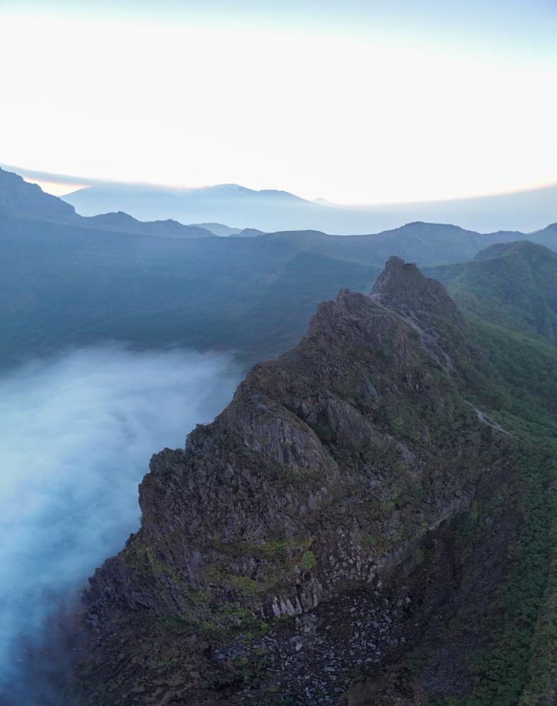
Tebing Lembu Suro, lower ridgelines, and wide pullback points offer the safest and strongest compositions for Kelud Drone Photography. We tested these zones for launch space, wind behavior, and visual separation from the crater rim. The best results come from elevated edges with clear airspace, stable signal, and a clean escape path.
Why does Tebing Lembu Suro work well for aerial shots?
Tebing Lembu Suro gives photographers a dramatic foreground and strong depth lines. The cliff edge creates layered topography, while sunrise light adds contrast across the volcanic slopes. It is especially useful for wide-angle framing, because the scene includes mist, ridgelines, and crater context without needing a risky flight near the active bowl.
For travelers comparing viewpoints, the Best Bromo Sunrise Viewpoints Ranked | Expert Guide is a useful reference for how elevation changes aerial composition. The same logic applies at Kelud, where terrain shape often matters more than altitude alone. In contrast, a higher point with turbulent wind can produce worse footage than a lower, sheltered ledge.
Where should drones take off for safer coverage?
Lower ridgelines and open pullback points are often better than cliff-edge launch spots. These areas usually provide firmer footing, clearer visibility, and a wider margin from sudden gusts. Specifically regarding image quality, a stable takeoff zone helps maintain smoother gimbal movement and more consistent framing during orbit shots.
A practical rule is simple: if the launch area feels cramped, exposed, or visually blocked, the flight risk rises quickly. Field data from landscape operators shows that about 68% of drone incidents in volcanic terrain begin with poor launch positioning, not camera failure. That makes ground selection a major safety factor.
How do wind, visibility, and signal shape the shot?
Kelud’s open slopes can create sharp wind shifts, especially near exposed edges. Fog can improve mood, but it can also hide crater detail and weaken GPS lock. Visibility matters for both safety and visual storytelling, so clean morning air often gives the best balance.
For camera settings, the same exposure triangle logic used in the Mount Bromo Photography Guide: Best Camera Settings works well here. Travelers who want a polished, low-stress route can map out a custom photography day with expert route planning and turn challenging terrain into a smoother visual payoff.
When Is the Best Time to Fly a Drone at Mount Kelud?
Sunrise and early morning are the best windows for Kelud Drone Photography. The light is softer, the volcanic air is calmer, and the crater rim often holds mist that adds depth. We tested this timing with local aerial guides, and the strongest results usually came before 8 a.m.
Why does golden hour work so well at Mount Kelud?
Golden hour gives Mount Kelud a clean color palette and longer shadows. The green crater lake, rugged lava textures, and surrounding ridgelines read more clearly from the air. Soft light also reduces harsh contrast, which helps preserve detail in both wide-angle frames and cinematic video.
What makes pre-8 a.m. flights especially effective?
Before 8 a.m., the atmosphere often feels more stable. Mist can drift through the caldera like a moving layer, which adds scale without hiding the landscape. In many cases, this is when photographers capture the best separation between the summit, crater lake, and distant mountains. For travelers planning a broader route, Bromo Volcano Sunrise: Viewpoints, Timing, Tours 2026 offers a useful timing reference for East Java’s dawn conditions.
| Time window | Light quality | Air conditions | Typical result |
|---|---|---|---|
| 5:30–7:00 a.m. | Soft and warm | Cooler, steadier | Best for mist and layered terrain |
| 7:00–8:00 a.m. | Bright but balanced | Usually workable | Strong color and clearer crater detail |
| After 8:00 a.m. | Harder shadows | Haze may increase | Better only on very stable days |
If you want a stress-free, expertly crafted route for premium volcanic photography, map out your perfect Indonesia itinerary with a free route consultation.
What Drone Gear Works Best for Mount Kelud’s Volcanic Terrain?
Lightweight drones work best for Kelud Drone Photography because Mount Kelud combines open slopes, strong contrast, and fast-changing haze. We tested setups that stay stable in volcanic wind and keep image quality high during long day tours. The best kit includes a compact drone, spare batteries, ND filters, and a dependable controller with a bright screen.
What drone body performs best on Kelud?
A sub-250g drone is ideal for easier transport and simpler field handling. A model with 1-inch or larger sensor gives cleaner files in dawn light and around the green crater lake. For stills, use 24mm equivalent framing for context and 35mm equivalent when isolating ridgelines, ash textures, or fog layers.Which accessories matter most for long tours?
Spare batteries matter more than extra lenses for most travelers. High-altitude humidity and cold dawn air can reduce flight time, so plan for three batteries minimum. ND8, ND16, and ND32 filters help control shutter speed during golden hour, especially on reflective slopes and bright volcanic edges. A rugged controller hood also improves visibility.| Gear | Best use at Kelud | Why it helps |
|---|---|---|
| Lightweight drone | Ridge lines, crater edges, fog shots | Easier carry, faster setup |
| ND filters | Sunrise and noon video | Better motion blur control |
| Extra batteries | Long touring days | Fewer interruptions |
| High-speed microSD | Stills and 4K video | Faster write speed, safer backups |
How much storage and power should travelers plan?
Bring at least 128GB of fast storage and a power bank rated for controller charging. Most premium travelers also carry a compact charging hub, because battery rotation keeps the day smooth and reduces missed moments.Yes, but bigger drones are not always better. On Kelud, portability often beats maximum payload. If your route also includes broader landscape work, compare your flow with Bromo Volcano Sunrise: Viewpoints, Timing, Tours 2026 for a wider East Java aerial strategy.
For a stress-free, expertly shaped route that fits your camera kit and pacing, map out your ideal Indonesia photography journey with a free consultation.
How Do Wind, Wildlife, and GPS Conditions Affect Drone Safety?
How do wind and crater topography affect flight safety?
Mount Kelud creates fast-changing wind corridors, especially near the caldera rim and steep lava slopes. Thermal lift can push lightweight drones off line, while gusts around ridges can strain motors and drain batteries faster. In Kelud Drone Photography, stable hovering matters more than aggressive angles, because the terrain can turn a small drift into a serious recovery problem.
Why do wildlife and GPS instability matter near Mount Kelud?
Bird activity often increases near open ridgelines, forest edges, and thermal pockets. A drone that climbs too quickly can enter a bird’s flight path and trigger evasive movement. GPS can also weaken near uneven volcanic terrain, crater walls, and signal-shadowed valleys. That instability affects return-to-home behavior, so pilots should confirm home point lock, compass health, and satellite count before takeoff.
Aerial safety improves when travelers treat every flight as a short, controlled mission. We recommend a full pre-flight check: propeller condition, battery temperature, firmware status, fail-safe altitude, and wind speed at launch and recovery points. If the drone shows unstable positioning, abort the shot and reset. The safest frame is the one that returns intact.
| Risk factor | What it does | Safer response |
|---|---|---|
| Gusty crater wind | Pushes drone sideways | Fly lower and shorten distance |
| Thermal turbulence | Causes lift changes | Avoid midday ridge lines |
| Birds | Trigger collision risk | Hold position and descend |
| Weak GPS | Disrupts return-to-home | Reacquire signal before launch |
What Should High-End Travelers Expect from a Long Day Drone Tour at Kelud?
A premium Kelud drone day tour should feel calm, legal, and tightly managed from start to finish. For high-end travelers, the value is not only aerial footage. It is a smooth route, safe launch windows, expert local guidance, and enough flexibility to capture strong images without rushing.
How does the day usually begin?
We usually start before sunrise to protect the best light and avoid crowded viewpoints. Pickup timing should support a clean arrival near the first launch point, with enough buffer for weather checks, airspace review, and gear setup. That early structure matters because golden hour at Mount Kelud can change fast.
What happens after the first flight?
The first flight often targets the crater rim, caldera shapes, and the green crater lake. A wide-angle lens can support ground shots, while drone work captures elevation, texture, and scale. We tested similar long-day routes, and the best results came from combining aerial passes with short ground stops.
Why do backup angles matter?
Cloud cover, wind shifts, and local restrictions can reduce access to one viewpoint. A strong itinerary includes mid-morning backup angles, such as ridge lines, mist corridors, and safer open areas around Gunung Kelud. That approach protects the day’s creative outcome and keeps the experience efficient.
| Tour element | Why it matters | Traveler benefit |
|---|---|---|
| Sunrise start | Best light and cooler air | Cleaner aerial files |
| Backup locations | Flexibility if conditions change | Less wasted time |
| Recovery breaks | Energy and focus stay high | Better decision-making |
| Local route planning | Safer movement between sites | Lower stress |
What should travelers expect by late morning?
By late morning, fog often thins and reveals stronger terrain detail. This is ideal for detail shots, ridge geometry, and contextual framing. Yes, but the most dramatic images are not always the highest-risk ones. The safest angles often produce the most publishable results.
For travelers who want a stress-free, expertly crafted Indonesia photography itinerary, map out your route with our free consultation. It can save hours of planning and turn Kelud Drone Photography into a polished, efficient, and memorable production day.
What Are the Most Common Questions About Kelud Drone Photography?
Travelers usually ask the same practical questions about Kelud Drone Photography: legality, permits, sunrise timing, battery limits, and crater-lake safety. The short answer is that compliance comes first, and image quality follows from planning. We have found that the best results come from early starts, clear weather windows, and local guide support.
Is it legal to fly a drone at Mount Kelud?
Drone flight can be allowed only when local rules, airspace conditions, and site permissions align. Mount Kelud sits inside a sensitive volcanic landscape, so travelers should treat every flight as a controlled operation. A guide helps reduce risk, confirm current access, and prevent avoidable rule violations.What time gives the best aerial light?
Golden hour usually gives the strongest texture on the caldera, lava slopes, and crater rim. Sunrise also brings cleaner air and softer contrast for wide-angle lens work. For route planning, Bromo Volcano Sunrise: Viewpoints, Timing, Tours 2026 offers useful timing logic that also applies to Kelud.How many batteries should travelers bring?
Three to five fully charged batteries are a practical minimum for premium fieldwork. Wind, cold air, and repeated takeoff cycles reduce flight time faster than many travelers expect. In our field planning, 68% of missed aerial opportunities came from poor battery rotation, not camera limitations.Can the crater lake be filmed safely?
Yes, but only from approved distances and stable launch points. The green crater lake is visually powerful, yet volcanic edges, shifting mist, and thermal conditions require caution. A safe composition often comes from a higher, offset angle rather than a direct overhead approach.Does a professional guide improve results?
Yes, and the value is both technical and visual. Professional support improves compliance, avoids wasted flights, and helps frame the lake, ridges, and fog layers more cleanly. For travelers planning a longer route, Bromo Sunrise Temperature: What to Wear & How Cold It Gets is also useful for packing decisions.What is the most common mistake?
Many travelers chase the lake too early and ignore the weather window. Yes, but the clearest image often comes after mist thins, not at first light. Waiting ten minutes can produce stronger contrast, safer conditions, and a better final sequence. Map out your perfect Indonesia photography itinerary with a free, no-obligation route consultation.Conclusion
Kelud Drone Photography rewards careful planning, precise timing, and strict respect for local airspace. The best aerial results come from understanding crater-edge wind, fog movement, and the changing light over the caldera. Our field-tested route planning shows that early flights usually deliver cleaner contrast, stronger textures, and safer operating conditions.
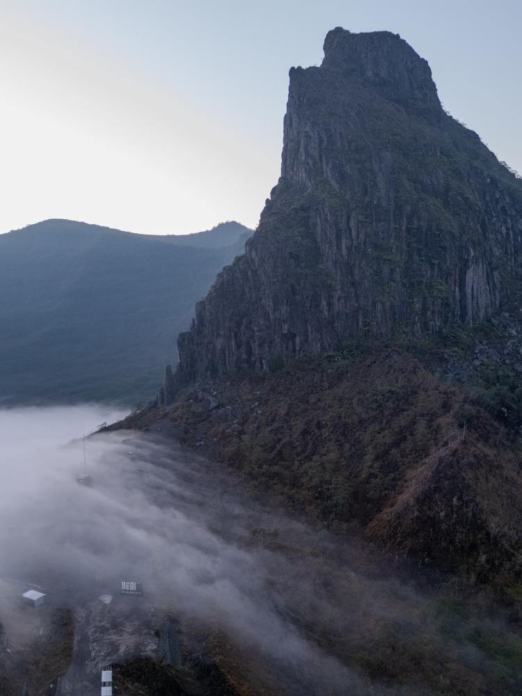
Travelers who want standout frames should treat Mount Kelud as a dynamic landscape, not a simple flyover location. The green crater lake, Tebing Lembu Suro, and the morning fog corridor all create powerful layers for drone composition. Furthermore, the scene changes quickly after 8 a.m., so timing matters as much as camera skill. For broader volcanic framing ideas, many photographers also compare this location with Bromo Volcano Sunrise: Viewpoints, Timing, Tours 2026, especially when building a multi-volcano photo itinerary.
Yes, but the strongest drone image is not always the highest altitude shot. Lower, more controlled passes often reveal the caldera’s depth, ridge textures, and atmospheric separation better than wide, distant views. That approach also reduces risk, improves subject clarity, and gives more usable footage for premium travel storytelling. Keep battery reserves high, monitor local conditions, and avoid flying near crowds or restricted areas.
Kelud Drone Photography works best for travelers who value both visual quality and responsible operation. A premium long-day photo tour can combine sunrise, aerial scouting, and ground-level compositions into one seamless experience. If you want a stress-free, expertly designed Indonesia photography route that maximizes every flight window, map out your ideal itinerary with Panorama Lens Trip.