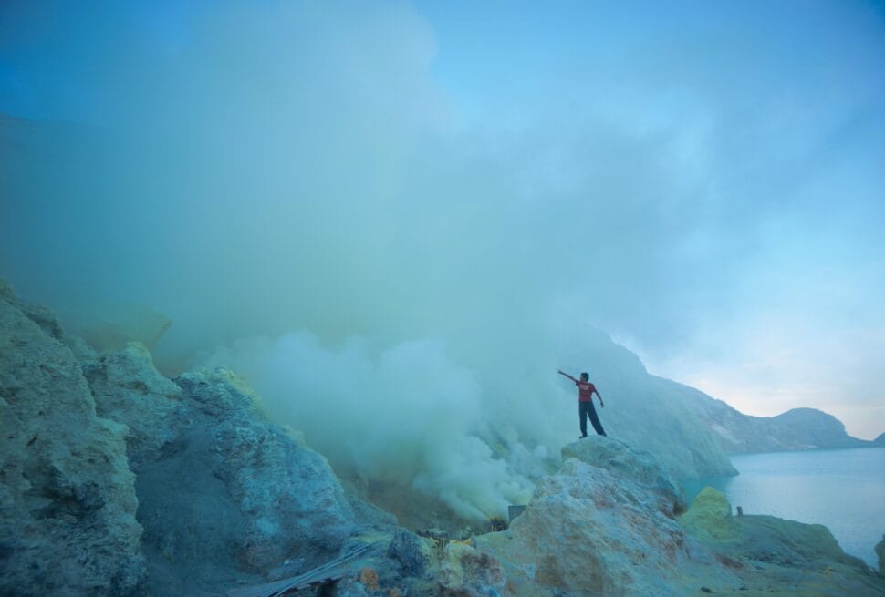
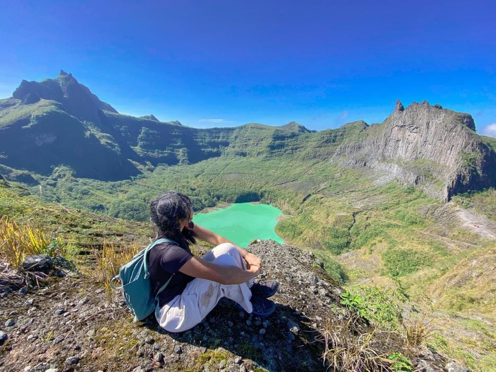
Can you legally fly a drone over an active crater lake and still come home with cinematic footage? At Mount Kelud, the answer depends on more than skill—it depends on understanding local rules, terrain, safety, and respect for a living volcanic landscape. For photographers and travelers planning Kelud Drone Photography, this matters because one mistake can mean losing signal, disturbing wildlife, or violating access rules in a protected area.
Mount Kelud is not a casual flying zone. Its crater, ridgelines, and summit viewpoints offer dramatic aerial composition, but they also sit within a dynamic environment where conditions can change quickly. In this article, you will learn how Mount Kelud drone rules shape what is possible, where a drone permit Mount Kelud may be needed, and how to approach the site with a responsible mindset. You will also find practical guidance on the best launch areas, safer flight timing, and how drone photography sunrise volcano conditions can create powerful images without compromising safety.
Whether you are planning a first visit or refining a professional workflow, Kelud Drone Photography is about more than capturing beautiful footage. It is about flying with awareness, preparing for volcanic light and weather, and making informed decisions before your drone ever leaves the ground.
Understanding Whether Drone Flights Over Mount Kelud Are Legal
The Core Legality Question
For Kelud Drone Photography, the first question is not just about image quality — it is whether the flight is allowed at all. In practice, the answer to “can you fly a drone at Mount Kelud” depends on several conditions at once: current volcanic activity, local visitor rules, forest or conservation status, and any temporary restrictions set by authorities. An area may be open for scenic visits while still having drone limits near the crater, around managed tourist facilities, or inside sensitive zones.
Mount Kelud is an active volcanic landscape, so safety rules can change quickly. Even if a drone is technically permitted in one part of the destination, that does not automatically mean it is allowed over the crater lake or within a restricted radius. Local government offices, village managers, park or tourism operators, and disaster agencies may all have a role in deciding what is acceptable on a given day.
Scenic Access Is Not the Same as Flight Permission
Travelers often assume that the best drone spots in Mount Kelud are open for free aerial use because the views are public-facing. That is not always true. Scenic access usually means you can visit and photograph from designated areas; it does not guarantee permission to launch or overfly an active crater.
The safest approach is simple: treat this article as practical guidance, not official approval. Before flying, check the latest updates from the park or tourism office, the local village authority, and Indonesia’s disaster agency notices. A quick confirmation before departure can prevent violations, protect others, and keep your drone session responsible and compliant.
Mount Kelud Airspace, Protected Area Status, and Local Authority Considerations
Multiple Layers of Oversight
Mount Kelud is not managed by a single rulebook. For Kelud Drone Photography, pilots need to consider aviation safety expectations, local tourism management, forest or conservation controls, and volcanic hazard restrictions at the same time. Even if a location seems open to visitors, drone activity may still be limited near the crater, along steep ridges, or in areas where staff are directing foot traffic. In practice, the safest approach is to confirm the latest access conditions with local officials, site managers, or any park-related authority before flying.
Why the Rules Can Change Quickly
Because Kelud is an active volcanic landscape, access can shift in response to weather, visibility, crowd levels, and geological activity. The Mount Kelud drone rules may change without much notice, especially if a viewpoint becomes busy, a route is closed, or the crater zone is placed under tighter control. A drone that is acceptable at one overlook may be prohibited closer to the summit or crater edge.
Practical No-Fly Checks
Before takeoff, identify:
– crater rims and steep drop-offs
– visitor trails and gathering points
– sunrise or sunset viewpoints with heavy foot traffic
– any signs, barriers, or staff instructions marking restricted space
If people are clustered at a lookout, keep well outside the area and avoid low passes overhead. Respecting these boundaries is not only about compliance—it also protects visitors, preserves the landscape, and supports responsible drone operations in a sensitive volcanic environment.
Best Drone Photography Sites at Mount Kelud for Safe Aerial Coverage
Lower Ridges for Broad Crater Views
For Kelud Drone Photography, the most practical launch and framing spots are usually the lower ridges and open viewpoints that look toward the crater rim without pushing the drone directly above the active center. These positions often provide a wide, layered composition: the crater lake, volcanic slopes, and surrounding terrain can all be captured in one frame while keeping the aircraft within safer visual range. If you are asking can you fly a drone at Mount Kelud, the smarter question is often where you can fly while maintaining stable control and clear line of sight.
Open Viewpoints for Safer Control
Open viewpoints are valuable because they reduce obstruction from trees, cliffs, and steep terrain that can interfere with signal reliability. They also make it easier to hold a steady hover for wide landscape shots, which is ideal when you want to show the scale of the crater lake and the shape of the volcanic ridges. These sites work especially well for establishing shots and slow lateral moves.
Scenic Areas Better Suited to Specific Shots
Some vantage points are better for cinematic motion, such as smooth reveal shots or gentle orbit-style movement, while others are stronger for detailed crater framing and still compositions. The best choice depends on terrain, wind, and how consistently your controller signal holds in the area. Gusty ridge tops may look dramatic, but safer, lower-elevation launch points often give better control and more reliable footage.
Plan for Safety and Visual Impact
Whenever possible, choose a site that lets you capture the crater lake and surrounding slopes without needing risky flight paths over unstable ground. In mountain environments, the strongest shot is usually the one that balances visual scale with careful positioning.
How to Plan a Safe Drone Flight Over an Active Volcanic Landscape
Start with Conditions, Not the Drone
Safe Kelud Drone Photography begins with a full terrain check, not a launch. On an active volcanic landscape, review weather forecasts, wind direction, cloud ceiling, and visibility before leaving for the site. Even if the sky looks clear at ground level, Mount Kelud’s crater slopes can generate sudden turbulence and shifting crosswinds. Avoid flying when gusts are stronger than your drone’s tested limit, and be especially cautious near ridgelines and the crater rim, where airflow can change quickly.
Confirm Navigation and Recovery Settings
Before takeoff, verify battery health, compass status, home point accuracy, and return-to-home altitude. Set RTH high enough to clear the terrain, but not so high that the aircraft drifts into stronger wind layers. Keep an emergency landing option in mind at all times, since volcanic ground may be uneven, loose, or unstable. If you are operating under a drone permit Mount Kelud arrangement, review any site-specific limitations first so your flight plan stays compliant and practical.
Keep Limits Conservative
Fast-changing light, steam haze, and low morning fog can reduce visibility and GPS reliability. For that reason, keep the drone within visual line of sight, avoid extended flights beyond your comfort level, and do not press closer to unstable edges just for a dramatic frame. A strong shot is never worth unnecessary risk.
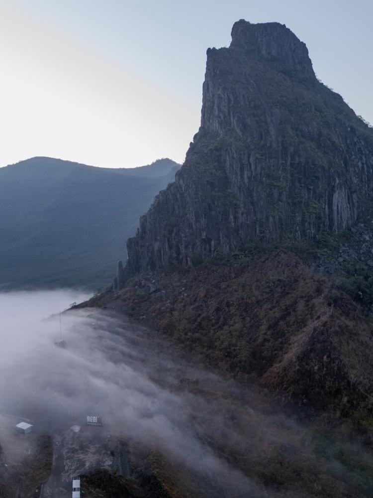
A disciplined pre-flight routine helps ensure that the best aerial images come from good planning, not from taking chances.
Recommended Drone Settings for Sunrise, Sunset, and Volcanic Contrast
Exposure and White Balance for Volcanic Light
For Kelud Drone Photography, sunrise and sunset are the best times to balance texture, color, and contrast around the crater. Start in manual exposure whenever possible so the camera does not overreact to bright sky reflections or the pale haze above the rim. A practical baseline is ISO 100–200, shutter speed around 1/50–1/120 for video, and an aperture near f/2.8–f/4 on drones that allow it. If you are shooting stills, expose for the crater lake highlights first, then lift shadows in post rather than letting the water clip to pure white or blown cyan-green.
Set white balance manually instead of using Auto. Around Mount Kelud, mist, volcanic haze, and the lake’s reflective surface can push colors too warm or too cool from frame to frame. A range of 5200K–6500K usually works well for golden hour, while a slightly cooler setting can preserve the natural mood when fog hangs in the valley.
ND Filters and Smooth Motion
Use ND filters to keep shutter speeds cinematic in bright conditions. An ND8 or ND16 is often enough at sunrise, while ND16 to ND32 may help during stronger sunset glare. This is especially useful at the best drone spots in Mount Kelud, where reflective crater edges and bright cloud layers can cause harsh highlights.
For movement, keep yaw turns slow and steady, with gentle forward motion to reveal the crater bowl and ridges. Avoid fast pans, which can make misty landscapes look unstable. Prioritize smooth, deliberate framing so the volcanic contrast stays clean and readable.
Battery Management, Weather Windows, and Flight Timing for Better Results
Plan for Short Windows, Not Long Flights
For Kelud Drone Photography, timing is as important as camera settings. Mount Kelud’s scenery can change quickly with fog, cloud cover, and shifting wind, so a short, well-planned window often produces better results than a rushed all-day session. Because battery life is limited, many travelers find that two or three batteries are a practical minimum if they want to move between viewpoints, wait for light changes, and still have enough power for a safe return.
Fly Early for Better Light and Calmer Air
Early morning is usually the most reliable time for a drone photography sunrise volcano session. Air movement is often gentler, visitor traffic is lower, and the softer light helps preserve detail in the crater, ridgelines, and surrounding slopes. In some cases, wildlife activity and mist patterns also shift later in the day, which can change composition opportunities and reduce visibility.
Monitor Conditions Before Every Flight
Check weather forecasts, live cloud cover, and temperature changes before takeoff. Even a small rise in heat can affect air stability, while fog may fill the valley and hide the crater within minutes. A good habit is to arrive early, scout the scene, and launch only when visibility, wind, and battery reserves all align. That approach helps keep Kelud Drone Photography efficient, calm, and complete.
Wildlife Awareness, Safety Distance, and Ethical Drone Practice at Mount Kelud
Respecting Wildlife, Visitors, and the Landscape
Responsible Kelud Drone Photography is not only about legal compliance; it is also about protecting a fragile volcanic environment and the experience of everyone on the mountain. Mount Kelud’s ridges, crater edge, and misty viewpoints can attract birds, small wildlife, and concentrated groups of travelers. Keep a generous safety buffer from cliffs, nesting zones, and any area where animals gather. As a practical rule, avoid repeated low passes and never chase birds for a dramatic shot. If wildlife changes direction, calls out, or leaves the area, back away immediately.
Maintain Distance and Minimize Disturbance
Do not fly close to the crater rim or hover directly above crowded viewpoints, even if the space looks open. A respectful distance reduces risk, noise, and panic among nearby visitors. Quick altitude changes, sudden turns, and repeated flyovers can be disruptive, especially in quiet morning conditions. If you are filming near a scenic overlook, plan your shots efficiently: one smooth take is better than multiple low passes.
Good Etiquette Around Other Travelers
Before takeoff, check whether other people are setting up photos, resting, or walking through the area. Launch and land from a clear spot, keep your aircraft in sight, and avoid hovering over anyone’s head or path. If the site becomes busy, pause your flight and wait for a quieter window. Ethical behavior helps protect both the environment and the credibility of drone pilots working in volcanic destinations.
What to Do If You Want Permission or Professional Drone Coverage at Mount Kelud
Start with the Site Manager and Current Rules
If you are asking can you fly a drone at Mount Kelud, the most reliable next step is to contact the local site manager before you travel. Regulations and access conditions can change with volcanic activity, visitor flow, weather, and conservation needs, so it is wise to confirm the latest Mount Kelud drone rules directly rather than relying on old trip reports. Ask whether a drone permit Mount Kelud is required, which zones are open, and whether there are time limits, altitude limits, or no-fly areas near the crater rim and visitor facilities.
Prepare a Clear Flight Plan
For smoother approval, share a concise plan that includes:
– Exact launch and landing location
– Planned flight time and duration
– Target subject, such as crater views or ridge lines
– Safety measures, including return-to-home settings and visual observer support
– Contingency plans if wind, fog, or volcanic alerts change
This is especially helpful for travelers and brands seeking polished Kelud Drone Photography results. If your goal is the best drone spots in Mount Kelud, ask which viewpoints are currently allowed and whether sunrise access is possible for drone photography sunrise volcano imagery.
Work With Local Expertise
Local guides and experienced drone teams can help interpret terrain, access routes, and real-time operational context. They may also know which angles are practical, which paths are safe, and how to adapt quickly if conditions shift. That support is often the difference between a stressful shoot and a well-managed production.
If you would like planning support, aerial content help, or location advice, you can reach out directly through Panorama Lens Trip for a more tailored approach.
Conclusion
In the end, the answer to the core question is clear: flying a drone directly over Mount Kelud’s active crater lake is not something travelers should assume is legally permitted. Because Kelud is an active volcanic landscape with protected areas, changing local rules, and safety-sensitive airspace, responsible operators must verify current permissions with the relevant authorities before any flight. For most visitors, the safest and most ethical approach is to keep drones well outside restricted zones and focus on approved viewpoints that still deliver dramatic results.
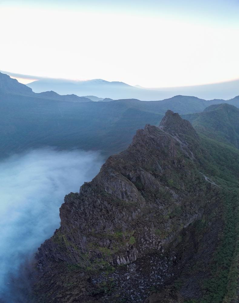
That is where Kelud Drone Photography becomes most rewarding: careful planning, respectful distance, and strong technical preparation can produce compelling aerial images without creating unnecessary risk. Sunrise and sunset flights, stable weather windows, and conservative battery management all matter, but none of those tactics replace legal compliance and situational awareness. If you want higher-impact coverage, seek formal permission, work with local guidance, and prioritize safety for people, wildlife, and the volcanic environment.
Ultimately, the best drone image is not the riskiest one—it is the one captured with skill, restraint, and respect. If you are ready to plan Kelud Drone Photography the right way, make permission and safety your first shot.