
Introduction
Mount Semeru has always held a powerful presence in Indonesian volcanology. Known locally as Mahameru, it is Java’s highest and one of its most active volcanoes. On 19 November 2025, Semeru once again demonstrated its explosive force as a major eruption sent pyroclastic flows racing down its slopes, reaching up to 8.5 km—a distance that alarmed both residents and authorities. This event stands out as one of the most significant eruptions in recent years, offering both scientific insight and a stark reminder of nature’s unpredictability.
Why Semeru Is One of Indonesia’s Most Active Volcanoes
Semeru lies on the Pacific Ring of Fire, an area known for intense tectonic activity. This location makes it a hotspot for volcanic eruptions, driven by the movement of the Indo-Australian plate beneath the Eurasian plate. Because of this geological setting, Semeru frequently produces explosive eruptions, ash plumes, and pyroclastic flows. Its crater, Jonggring Seloko, is constantly active, contributing to the volcano’s classification as a high-risk zone. Regular activity includes daily ash emissions, minor explosions, and lava dome growth—signs that the volcano is always awake and capable of escalation.
Overview of the 19 November 2025 Event
Mount Semeru eruption on 19 November 2025 was particularly notable due to the unusual reach of its pyroclastic flows. Semeru has erupted many times before, but the intensity and distance of this event raised concerns. The eruption produced towering ash columns, loud explosive sounds, and rapid pyroclastic currents that raced down the mountainside. Local authorities quickly raised the alert level, prompting immediate evacuation in several areas around Lumajang.
What Happened on 19 November 2025?
The Pyroclastic Flow Movement
Pyroclastic flows are one of Semeru’s most dangerous hazards, and on this day, they moved faster and farther than expected. These flows consisted of hot volcanic ash, gas, and rock fragments that surged down the channels carved into the mountain’s surface. They followed river valleys and steep slopes, moving with terrifying speed toward inhabited areas. The dense, fast-moving clouds left behind scorched vegetation and thick deposits of volcanic material.
Distance, Speed, and Impact of the 8.5 KM Flow
The pyroclastic flow traveled 8.5 km, a significant distance that approached several villages near Lumajang. Flows of this length indicate powerful explosive pressure within the volcano. With temperatures often exceeding 700°C and speeds comparable to a fast-moving vehicle, these flows can destroy virtually anything in their path. The aftermath included buried farmland, damaged homes, and disrupted access roads. The extreme reach of the flow reinforced why Semeru is monitored closely year-round.
Understanding Pyroclastic Flows
What Are Pyroclastic Flows?
Pyroclastic flows are rapid, ground-hugging avalanches of hot gas, ash, and volcanic fragments. Unlike lava, which moves relatively slowly, pyroclastic flows can travel at high speeds—sometimes over 80 km/h. They form when the eruption column collapses or when part of a lava dome explosively breaks apart. These flows are among the deadliest volcanic hazards because of their unpredictability and destructive force.
Why They Are Extremely Dangerous
The danger of pyroclastic flows comes from three main factors:
- Speed – They move faster than people can run.
- Heat – Temperatures can instantly ignite materials and cause severe burns.
- Density – They contain solid debris capable of flattening structures.
When these elements combine, pyroclastic flows become lethal to anything within their reach. They can bury entire landscapes, destroy bridges, and suffocate living organisms in seconds.
How the 8.5 KM Flow Compares to Previous Semeru Eruptions
Semeru has produced destructive pyroclastic flows in the past—most notably in 2021 and the following years. However, the 8.5 km distance recorded in 2025 is one of the longest in recent history. This suggests heightened volcanic pressure and possibly increased magma supply beneath the crater. Such distances are rare and considered high-risk events for nearby communities.

Visual and Geological Signs Before the Eruption
Increased Seismic Activity
Several days before the eruption, monitoring stations detected rising volcanic tremors. These tremors occur when magma pushes upward, fracturing surrounding rock. As the frequency of these tremors grew, experts predicted that a stronger eruption could occur soon. Seismic spikes are one of the earliest indicators of volcanic unrest.
Ash Plumes and Gas Emissions
Before the major eruption, Semeru also released thicker-than-usual white and gray ash. These plumes carried sulfur gases and volcanic particles, signaling intensified activity inside the crater. Residents around Lumajang reported ashfall on rooftops and vehicles even before the main event, suggesting that Semeru was preparing for a more powerful explosion.
Monitoring Alerts from Local Authorities
Indonesia’s Center for Volcanology and Geological Hazard Mitigation (PVMBG) issued early warnings as signs of unrest increased. Residents were advised to keep a safe distance from river valleys and avoid areas within the danger zone. These alerts played a critical role in reducing casualties when the eruption finally occurred. Monitoring systems, combined with rapid communication from local authorities, helped guide evacuations and emergency responses efficiently.
Impact on Surrounding Villages
The eruption of Mount Semeru on 19 November 2025 brought significant consequences to the surrounding villages, especially those located in Lumajang Regency. The intense pyroclastic flow and heavy ashfall caused disruptions that affected livelihoods, mobility, and daily life for thousands of residents.
Effect on Local Communities
Local communities experienced immediate shock and fear as the eruption unfolded. Thick ash darkened the skies, making visibility extremely low, while the roaring sound of the pyroclastic flow created panic among residents. Many families were forced to leave their homes in haste, carrying only essential belongings. Schools were closed, local markets halted operations, and transportation routes became hazardous due to slippery ash-covered roads. For communities reliant on agriculture and tourism, the eruption brought both economic and emotional strain. Daily routines were replaced with evacuation efforts, emergency shelter stays, and uncertainty about the days ahead.
Damage to Infrastructure and Crops
Ashfall and pyroclastic deposits caused extensive damage. Roofs of lightweight structures collapsed under the weight of volcanic ash, especially in areas closest to the mountain. Farmlands—one of the primary sources of income for villagers—were buried under layers of ash and sand. Crops such as vegetables, rice, and fruit trees suffered immediate damage from both the heat and chemical composition of the ash. Water supply systems were also affected when volcanic material washed into rivers and irrigation channels. Roads connecting Lumajang to other regions became blocked, slowing rescue efforts and disrupting the distribution of aid.
Evacuation Efforts and Emergency Response
Within hours of the eruption, local authorities initiated rapid evacuation procedures. Emergency teams, including volunteers and disaster response units, worked together to move residents to safer locations such as community halls and temporary shelters. Medical tents were set up to treat respiratory issues caused by inhaling ash. Masks, clean water, and blankets were distributed across various evacuation centers. Despite the chaos, the coordinated efforts helped ensure that families reached safety before conditions worsened. Regular announcements and text alerts played a crucial role in guiding residents away from high-risk zones.
Environmental Impact
The eruption significantly altered the environment around Mount Semeru. From changes in topography to disruptions in water systems, the event left long-lasting ecological effects.
Changes to the Mountain Landscape
The pyroclastic flow carved new channels down the mountain’s slopes. Forested areas near the base were scorched, leaving behind barren land covered in dark volcanic material. The eruption reshaped valleys and riverbanks as hot flows bulldozed through vegetation and rock formations. The southern slope, in particular, experienced heavy deposition of ash and debris, creating new sediment layers that will remain for years. The landscape now reflects the dramatic force of the eruption, with newly formed paths that show exactly where the pyroclastic flow traveled.
Effects on Rivers and Watersheds
Rivers near Semeru, such as Besuk Kobokan, were approximately heavily impacted by the flow of volcanic material. Hot ash and debris entered river channels, raising water temperatures and reducing oxygen levels—conditions harmful to aquatic life. Sediment accumulation increased the risk of lahars, or volcanic mudflows, especially during heavy rainfall. These mudflows can travel great distances and cause secondary disasters long after the initial eruption. Water sources used by local communities also became contaminated, prompting authorities to distribute clean water and warn residents against using river water temporarily.
Long-Term Ecological Consequences
It may take years for vegetation to recover in areas hit by the pyroclastic flow. Soil composition changes as volcanic materials break down, initially creating harsh conditions but eventually adding minerals that enhance fertility. Wildlife habitats were disrupted, forcing animals to relocate or perish due to extreme heat and habitat destruction. The long-term ecological recovery will depend on rainfall patterns, erosion processes, and human intervention. Over time, new plant species may emerge, creating a different ecosystem than what existed before the eruption.
Eyewitness Accounts
Stories from Residents
Many residents shared emotional stories of the eruption. Some described hearing a thunder-like explosion followed by trembling ground. Others spoke of watching a massive gray cloud rushing down the mountain at terrifying speed. Parents recounted grabbing their children and running as ash filled the sky. Despite fear and uncertainty, stories of bravery and community support were abundant, with neighbors helping each other evacuate.
Footage and On-Ground Reports
Videos captured by locals showed the pyroclastic flow descending rapidly, engulfing everything in its path. Journalists on the ground documented ash-covered landscapes, emergency workers assisting families, and long lines of evacuees heading toward shelters. These visual reports helped the world understand the scale of the disaster and the strength of the affected communities.

Comparisons to Previous Semeru Eruptions
Major Past Eruptions
Semeru has erupted multiple times throughout history, with significant events occurring in 2021, 2022, and 2023. These eruptions also produced pyroclastic flows, ash plumes, and evacuations. However, the scale of pyroclastic reach in 2025 exceeded many previous events.
What Makes the 2025 Eruption Different
The key factor that sets the 2025 eruption apart is the 8.5 km pyroclastic flow, one of the longest in recent years. The intensity, reach, and environmental impact make it a standout event in Semeru’s eruptive record. Enhanced seismic activity leading up to the eruption also suggested deeper magma movement, which may indicate evolving volcanic behavior.
Safety Recommendations for Residents and Tourists
After the powerful eruption of Mount Semeru on 19 November 2025, safety guidelines have become more essential than ever. Whether you are a local resident or a visiting tourist, understanding what to do during volcanic activity can help protect you from the most dangerous hazards—especially ashfall, pyroclastic flows, and lahars. These recommendations are designed to help everyone stay informed, cautious, and prepared.
What to Do During an Ashfall
Ashfall is one of the most common hazards during an eruption, and while it may seem less dramatic than pyroclastic flows, it can be extremely harmful when inhaled or when it accumulates on roofs and roads.
Here’s what residents and tourists should do:
- Stay Indoors whenever possible. Volcanic ash contains tiny, abrasive particles that can irritate your eyes, throat, and lungs.
- Wear masks and goggles if you must go outside. A proper N95 mask or equivalent is ideal, but even a double-layer cloth mask is better than nothing.
- Close all windows, doors, and ventilation points to prevent ash from entering your home or hotel room.
- Protect water sources, such as wells or open containers, by covering them tightly. Ash can contaminate water quickly.
- Avoid driving, as ash makes roads slippery and reduces visibility. Driving through ash can also severely damage engines.
- Regularly clear ash from roofs if it accumulates heavily, especially on flat surfaces. Ash can be surprisingly heavy and cause roofs to collapse.
Tourists visiting Semeru or nearby destinations such as Bromo or Lumajang should follow local updates closely. Ashfall can affect these areas even if they seem far from the eruption site.
Safe Distance Guidelines During Eruptions
Eruptions can escalate quickly, and Mount Semeru is known for sudden pyroclastic flows that travel at high speeds. Staying at a safe distance is critical.
Here are the recommended guidelines:
- Always remain outside the 13 km danger zone when Semeru is on heightened alert. This zone is determined by the Indonesian volcanology agency (PVMBG) and should be strictly followed.
- Avoid river valleys such as Besuk Kobokan, which are common pathways for pyroclastic flows and lahars. Even after an eruption, these areas remain highly dangerous during heavy rain.
- Do not attempt to hike or climb the mountain during increased volcanic activity. Semeru’s summit route has been closed multiple times due to instability, hidden crevices, and sudden eruptions.
- Follow all road closures and warning signs, even if pathways look safe. Conditions can change rapidly, making restricted areas extremely hazardous.
For tourists specifically, it’s important to check the local disaster agency updates before planning sunrise trips, photography sessions, or trekking routes near Semeru.
Preparedness Tips for Future Activity
Living near or visiting an active volcano requires preparedness. Here are essential tips to stay ready for future eruptions:
- Keep an emergency bag with masks, bottled water, a flashlight, a power bank, and basic first aid items.
- Learn evacuation routes in advance; knowing where to go increases survival chances during sudden eruptions.
- Stay informed through official channels such as PVMBG, BNPB, or local disaster management authorities.
- Have a communication plan with family members or travel companions in case of separation.
- Monitor weather conditions, especially during rainy seasons, as lahars can occur long after the eruption ends.
For visitors, hotels and tour operators in Lumajang and Malang often provide safety briefings—don’t skip them.

The Future of Mount Semeru
Even after the dramatic eruption in November 2025, Mount Semeru remains highly active. Understanding what lies ahead is crucial for long-term safety and planning.
Monitoring Activity Post-Eruption
Following the eruption, volcanologists continue to track Semeru’s behavior closely. Monitoring efforts include:
- Seismic activity analysis, to detect magma movement beneath the surface.
- Gas emission measurements, which help determine pressure buildup in the crater.
- Thermal imaging, used to observe heat signatures from pyroclastic deposits and lava domes.
- Deformation monitoring, which tracks changes in the mountain’s shape that could indicate increased activity.
These systems help scientists predict potential eruptions, giving residents time to evacuate. Continuous monitoring provides essential data that influences alert levels and public safety decisions.
Potential Scenarios Moving Forward
Semeru’s future remains uncertain, but several potential scenarios are possible:
- Continued minor eruptions, with ash emissions and small pyroclastic flows—Semeru’s typical activity pattern.
- Formation of a new lava dome, which could eventually collapse and trigger another major pyroclastic flow.
- A period of relative calm, though this is less common given Semeru’s history.
- A larger, more explosive event, depending on magma accumulation and internal pressure.
Local authorities and scientific teams are prepared for all scenarios and continue updating the public as new data emerges.
Conclusion
The eruption of Mount Semeru on 19 November 2025, with its pyroclastic flows reaching an alarming distance of 8.5 km, highlights the immense power and unpredictability of active volcanoes. For residents, the eruption brought challenges—from ash-covered homes to evacuation stresses. For the environment, the landscape was drastically reshaped, rivers were disrupted, and long-term ecological recovery will take years.
However, thanks to rapid evacuation efforts, coordinated government response, and resilient communities, the impacts were managed more effectively than in past disasters. As Semeru remains active, both residents and tourists must stay informed, prepared, and aware of safety guidelines. With proper monitoring and readiness, lives can be protected even in the face of nature’s most powerful forces.
FAQs
1. Is it safe to visit after the Mount Semeru eruption?
It depends on the alert level. Always check updates from PVMBG and local authorities before planning a visit.
2. What makes pyroclastic flows so dangerous?
They move at high speeds and reach extremely high temperatures, destroying everything in their path.
3. How far should I stay from the crater during activity?
Authorities recommend staying at least 13 km away from the summit during heightened alert periods.
4. Are lahars still a threat after the eruption?
Yes. Rain can mobilize volcanic deposits, creating dangerous mudflows long after the main eruption.
5. How can tourists prepare for unexpected eruptions?
Carry masks, stay updated through official channels, avoid river valleys, and follow all evacuation instructions immediately.
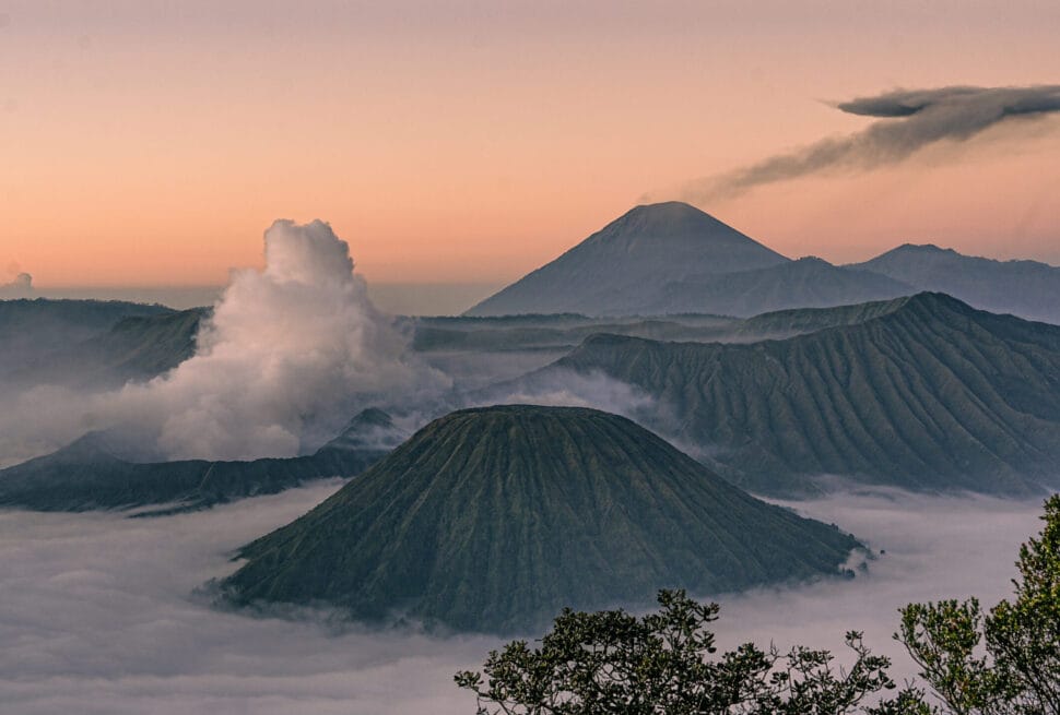
[…] Mount Semeru, the tallest volcano in Java, erupts almost daily. Its iconic plume rising into the sky is a signature image of the Ring Of Fire Indonesia. Semeru’s explosive history and stunning summit attract hikers from around the world. […]