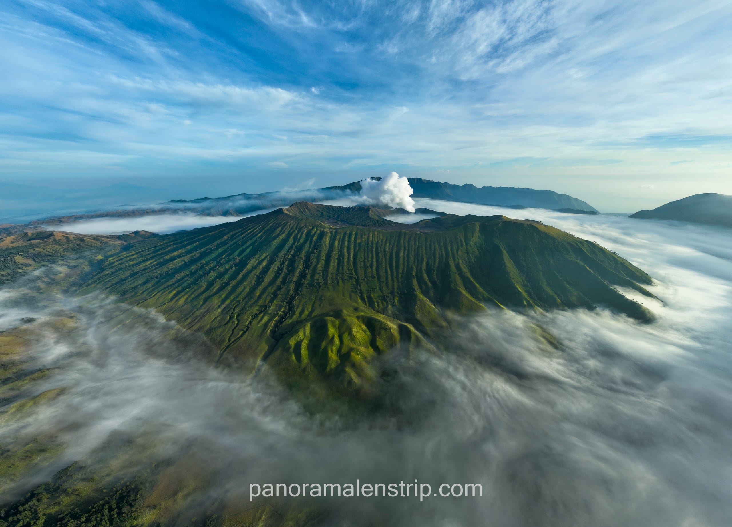
Mount Bromo, one of Indonesia’s most iconic volcanoes, is famous for its moon-like desert landscape, smoking crater, and dramatic sunrise views over the Tengger Caldera. While many travelers reach Bromo by jeep, hiking offers a richer, more immersive experience. Exploring the Bromo Hiking Routes allows you to witness hidden paths, ancient Tengger villages, volcanic ridges, and panoramic viewpoints untouched by crowds.
This ultimate guide covers everything you need to know about hiking Mount Bromo: route options, trail difficulty, distances, safety tips, local culture, preparation, and recommended itineraries.
Introduction to Bromo Hiking
Located in East Java, Mount Bromo stands at 2,329 meters and sits in the heart of Bromo Tengger Semeru National Park. Despite its modest altitude, Bromo’s landscape represents one of the most dramatic volcanic regions on Earth. The active crater, surrounded by the vast Sea of Sand, offers an adventurous setting for trekkers.
Unlike the typical jeep tour, trekking Bromo allows hikers to:
- Explore lesser-known ridges and viewpoints
- Experience quiet sunrise spots
- Interact with Tenggerese locals
- Enjoy a more environmentally friendly adventure
- Capture unique photography angles
With several marked and unmarked trails, the Bromo Hiking Routes cater to beginners, intermediate hikers, and experienced trekkers.
Overview of the Main Bromo Hiking Routes
There are five primary hiking routes around Mount Bromo, each offering different scenery and levels of difficulty.
A. Cemoro Lawang to Mount Bromo Crater (Classic Route)
- Difficulty: Easy to Moderate
- Duration: 45–60 minutes to the Sea of Sand, 40 minutes to crater
- Distance: 3–4 km
This is the most popular and beginner-friendly route. Starting from the village of Cemoro Lawang, hikers descend into the Sea of Sand, cross the expansive desert, and ascend Bromo’s crater rim using a mix of sandy paths and stairs.
Highlights:
- Sea of Sand desert walk
- Whispering Sands area in the early morning
- Active crater with roaring volcanic sound
B. King Kong Hill & Penanjakan Sunrise Trek
- Difficulty: Moderate
- Duration: 2.5–3 hours each way
- Distance: 6–7 km
This route offers the famous sunrise overlooking Bromo, Batok, and Semeru. Instead of going by jeep, hikers climb from Cemoro Lawang through pine forests and ridges up to King Kong Hill (Bukit Kingkong) or Mount Penanjakan.
Highlights:
- Jaw-dropping sunrise above Bromo
- Clear view of Mount Semeru emitting smoke puffs
- Suitable for photography lovers
C. Seruni Point Route (Alternative Sunrise Hike)
- Difficulty: Easy to Moderate
- Duration: 1.5–2 hours
- Distance: 3–4 km
Seruni Point is an underrated viewpoint providing a similar angle to Penanjakan but with fewer crowds. The trail begins from Cemoro Lawang and follows paved paths and stairs.
Highlights:
- Quieter sunrise spot
- Excellent night-sky photography
- Perfect for hikers with limited time
D. Bromo Crater Rim Circumference Trail
- Difficulty: Moderate to Difficult
- Duration: 2–3 hours
- Distance: 3 km around the crater
You can walk around the entire rim of Mount Bromo’s crater—something many visitors don’t realize. The path varies from wide and firm to narrow and steep, requiring caution.
Highlights:
- 360° view of the caldera
- Close-up crater geometry
- One of the most adventerous Bromo Hiking Routes
E. The Sand Whispering Route via Ngadas Village (Scenic Adventure Route)
- Difficulty: Moderate
- Duration: 4–6 hours
- Distance: 10–12 km
This lesser-known trail begins from Ngadas Village, one of the highest settlements in Java. The trek crosses rolling hills, forested valleys, and wide savanna before entering the Sea of Sand.
Highlights:
- Authentic Tengger culture
- Green savanna fields
- A long but rewarding countryside hike
Also read: Bromo Volcano Tour: A Complete Guide to an Epic Adventure
Detailed Breakdown of Each Route
1. Cemoro Lawang to Bromo Crater: Step-by-Step
Stage 1: Cemoro Lawang to the Edge of the Caldera
You start at Cemoro Lawang village and walk 15 minutes to the caldera edge, overlooking the Sea of Sand. Early morning mist often floats below, creating surreal views.
Stage 2: Descending Into the Sea of Sand
A steep but manageable slope leads down to the sandy desert. Early morning is best—cool temperatures and stunning light.
Stage 3: Crossing the Desert
This flat stretch takes 20–30 minutes. Iconic landmarks include:
- Pura Luhur Poten (Hindu temple)
- Tenggerese horse guides
- Endless volcanic dust fields
Stage 4: Climb to the Crater Rim
The final ascent involves sandy paths and a staircase leading to the edge of the smoking crater.
Best Time: Sunrise to avoid crowds and heat.
2. King Kong Hill & Penanjakan Trail: Step-by-Step
Stage 1: Cemoro Lawang to Forest Trail
The trek starts from the village and climbs through forested paths.
Stage 2: Ascent to the Ridge
Several switchbacks lead to the ridgeline, with increasing panoramic views.
Stage 3: Final Push to King Kong Hill
This section is steeper, but well marked. King Kong Hill is less crowded; Penanjakan is further uphill.
Stage 4: Sunrise View
Witness Bromo glowing in the soft morning light as Semeru bursts steam into the sky.
Best Time: Start at 2:00 AM for sunrise.
3. Seruni Point Sunrise Route: Step-by-Step
Stage 1: Paved Trail from Cemoro Lawang
Follow the paved road uphill, passing small guesthouses and farms.
Stage 2: Stairs to the Viewpoint
A long staircase leads to the official Seruni Point platform.
Stage 3: Sunrise Viewing
Enjoy sweeping views of the entire caldera with fewer vehicles and noise.
Best Time: Perfect for solo hikers and photographers.
4. Bromo Crater Rim Circumference: Step-by-Step
Stage 1: Reach the Crater Rim
After hiking the classic route, continue beyond the viewing platform.
Stage 2: Begin the Circular Path
Trails differ—some sections are wide, others narrow.
Safety Note:
Wear hiking shoes and avoid windy conditions.
Stage 3: Southern Ridge
This area offers dramatic ridge views and volcanic textures.
Stage 4: Completing the Loop
Approximately 2–3 hours depending on conditions.
5. Ngadas Village to Sea of Sand Route: Step-by-Step
Stage 1: Start in Ngadas Village
A scenic Tengger village at high altitude.
Stage 2: Hike Through Hills & Savanna
Rolling green landscapes with incredible photography spots.
Stage 3: Enter the Sea of Sand
The savanna gradually transitions into volcanic desert.
Stage 4: Reach Bromo Crater or Sunrise Spots
You can continue to the crater or climb to viewpoints.
Also read: Bromo Tumpak Sewu Photography Spots, Where is The Best?
Fitness Level and Difficulty Assessment
Mount Bromo hikes are generally accessible for beginners, but some routes require better fitness.
Easy Routes
- Cemoro Lawang to crater
- Seruni Point
Suitable for families, older hikers, and kids with supervision.
Moderate Routes
- King Kong Hill / Penanjakan
- Ngadas Village route
These require stamina and proper footwear.
Difficult Route
- Crater Rim Circumference
Not recommended for those afraid of heights or without hiking experience.
Also read: Bromo Jeep: Ultimate Adventure Guide
Safety Tips for Bromo Hiking Routes
Check Weather and Volcanic Activity
Mount Bromo is active. Check status from:
- Local guides
- National park authorities
Start Early
Avoid heat, dust, and crowds.
Bring Essentials
- Mask (to filter volcanic dust)
- Water (1–1.5 L)
- Trekking shoes
- Headlamp (for sunrise hikes)
- Windproof jacket
Beware of Horses
Many horses cross the routes. Stay aware of your surroundings.
Windy Crater Rim
Stay on stable ground; do not stand too close to the edge.
Also read: Enjoy a Private Bromo Tour Package Experience
Weather and Best Season for Hiking
Understanding the weather is essential for anyone planning to explore the various Bromo Hiking Routes. Mount Bromo’s high-altitude environment and open caldera landscape create conditions that can change quickly, especially during sunrise treks. The region has two main seasons: the dry season and the rainy season, and both significantly influence your hiking experience.
The dry season, from April to October, is the best time for hiking. During these months, the skies are clearer, temperatures are more stable, and sunrise visibility is at its peak. Trails along the Bromo Hiking Routes—such as King Kong Hill, Seruni Point, and the classic crater path—are easier to navigate because the ground is dry and firm. Photographers also benefit from golden morning light and minimal fog.
Morning temperatures during the dry season can drop to 5–10°C, so layering is important. Evenings and early mornings are cold, but once the sun rises, the caldera warms up quickly.
The rainy season, from November to March, brings wetter and more unpredictable conditions. Trails can become muddy and slippery, especially the steeper sections leading to viewpoints. Fog is more common, lowering visibility and making sunrise views less reliable. However, the landscape becomes greener and more dramatic, which can appeal to nature lovers. If you hike during the rainy season, always check weather updates and bring a waterproof jacket.
Overall, the best season for exploring the Bromo Hiking Routes remains the dry months, ensuring safer trails and clearer views.
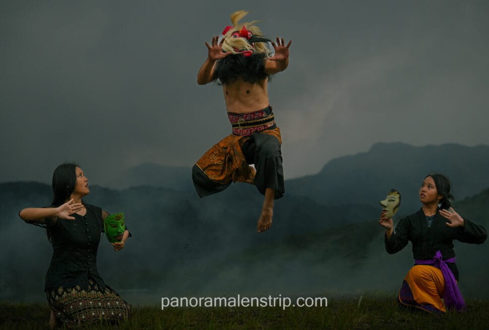
Cultural Insights: Tenggerese People
No journey through the Bromo Hiking Routes is complete without understanding the culture of the Tenggerese people, the native inhabitants of the Bromo region. The Tenggerese are believed to be descendants of the ancient Majapahit Kingdom, preserving a unique blend of Hindu traditions, highland customs, and strong community values.
Their villages—such as Cemoro Lawang, Ngadas, and Wonokitri—are often starting points for popular hiking routes. As trekkers pass through these areas, they encounter terraced fields, traditional homes, and warm local hospitality. The Tenggerese lifestyle is deeply connected to agriculture, spirituality, and the volcanic landscape surrounding Mount Bromo.
One of the most significant cultural events is the Yadnya Kasada Festival, held annually at the Bromo crater. During this ceremony, the Tenggerese present offerings—such as crops, livestock, and food—into the crater to honor their ancestors and seek blessings. Many hikers witness this tradition while exploring nearby Bromo Hiking Routes.
Understanding the Tenggerese culture enriches your hiking experience, offering a deeper appreciation of Mount Bromo’s spiritual significance and its connection to the people who have lived here for centuries.
Essential Packing List for Bromo Hiking
Clothing
- Thermal layer
- Fleece jacket
- Windproof outer layer
- Hiking shoes
- Hat & gloves
Gear
- Headlamp
- Sunglasses
- Dust mask
- Daypack
Optional
- Trekking poles
- Camera tripod
- Snacks
Sample Itineraries for Bromo Hiking Routes
A. Short Sunrise Hiking Itinerary (Ideal for Beginners)
2:00 AM – Start trek to Seruni Point
4:30 AM – Sunrise at Seruni Point
6:00 AM – Trek to Sea of Sand
7:00 AM – Hike up to Bromo Crater
9:00 AM – Return to Cemoro Lawang
B. Full-Day Trekking Itinerary (Adventure Lovers)
2:00 AM – Trek to King Kong Hill
4:30 AM – Sunrise at King Kong Hill
6:00 AM – Descend to Sea of Sand
7:00 AM – Explore Pura Luhur Poten
8:00 AM – Hike up to crater
10:00 AM – Begin crater rim loop
1:00 PM – Return via desert
C. Multi-Route Adventure (2-Day Trek)
Day 1:
- Ngadas to Savanna Route
- Explore Whispering Sands
- Overnight in Cemoro Lawang
Day 2:
- Sunrise at King Kong Hill
- Crater hike
- Return by afternoon
Photography Tips for Bromo Hiking Routes
Best Spots
- King Kong Hill ridge
- Seruni Point
- Sea of Sand sunrise mist
- Crater rim (southern side)
- Savanna fields
Best Timing
- 4:30–6:00 AM for golden light
- 8:00–9:30 AM for crater detail
- Afternoon (3:00–5:00 PM) for dramatic shadows
Camera Recommendations
- Wide lens for caldera
- Tele lens for Semeru
- Tripod for sunrise
Environmental Responsibility
Help protect Bromo by:
- Staying on marked trails
- Not littering
- Avoiding loud noise during sunrise
- Not disturbing wildlife
- Reducing jeep use by choosing hiking routes
Final Tips for a Successful Bromo Hiking Experience
- Book accommodations in Cemoro Lawang for easier access
- Always carry a mask due to dust
- Wear layers—temperatures can drop below 10°C
- Bring cash for snacks or horse rentals
- Use a local guide if unfamiliar
Conclusion
The Bromo Hiking Routes offer a unique opportunity to explore one of Indonesia’s most dramatic volcanic landscapes at your own pace. Whether you prefer a simple sunrise stroll, a demanding ridge hike, or a cultural countryside trek, Mount Bromo provides unforgettable scenery at every step. Hiking gives you freedom, intimacy with nature, and the chance to see breathtaking views away from the usual jeep tours.
For travelers seeking a deeper, more authentic connection to Bromo, trekking the routes outlined in this guide will be one of the most rewarding adventures in Indonesia.
Also read: Surabaya to Ijen Blue Fire Tour: Best Routes and Tips

[…] Learn more: Bromo Hiking Routes: Ultimate Guide to Hiking Mount Bromo […]