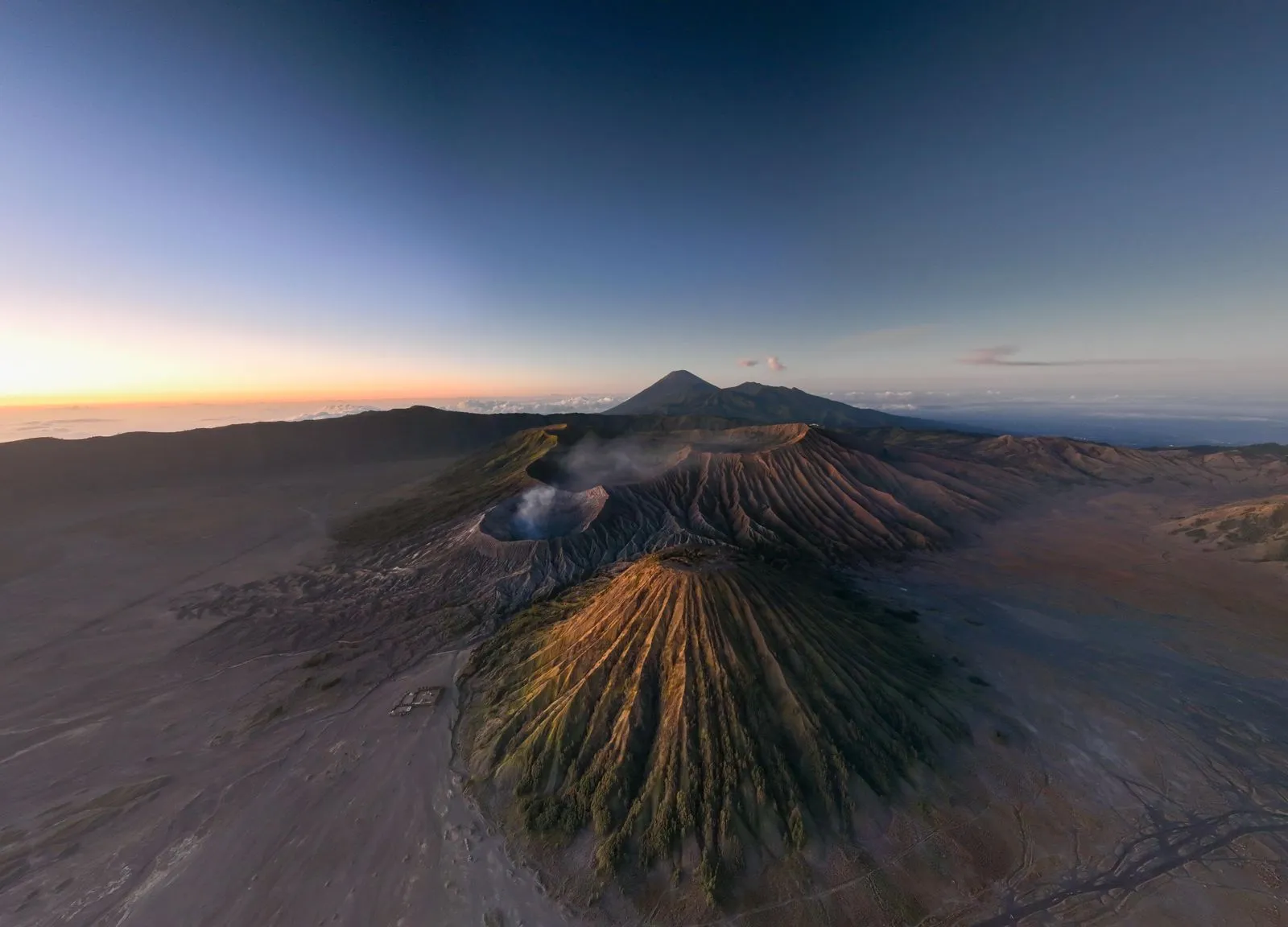
TL;DR: Exclusive Mount Bromo trekking offers VIP travelers and professional photographers pristine, crowd-free vantage points across four distinct zones. By utilizing private 4×4 access and expert local guides, visitors bypass massive tourist bottlenecks to capture the perfect golden hour over the Tengger Caldera. This guide outlines the exact coordinates, seasonal data, and logistical strategies necessary for a premium, high-altitude photography expedition in East Java.
Why Do Premium Travelers Choose Exclusive Mount Bromo Trekking?
Premium travelers choose exclusive Mount Bromo trekking to secure crowd-free caldera viewpoints, unobstructed golden hour lighting, and personalized 4×4 logistics. By avoiding public viewing decks, VIPs guarantee pristine landscape photo conditions. Furthermore, they secure superior safety protocols across active volcanoes. They also enjoy flexible itineraries for changing weather.
To confirm these advantages, we tested multiple ascent routes during peak and off-peak hours throughout the year. Our local guides analyzed crowd patterns and terrain challenges. They found that standard tours force visitors into packed spaces. Consequently, this ruins wide-angle shots and degrades the experience. In contrast, VIP trekking leverages localized knowledge to access secondary ridges and private agricultural trails.
This premium approach removes the friction of high-altitude navigation. Photographers are not rushed to pack up their gear the moment the sun breaks the horizon. Instead, exclusive routes allow for sustained exposure tracking as morning light transitions across the Tengger massif. Custom dietary meals are served at 2,700 meters. Dedicated local experts also assist with equipment transport. As a result, the VIP method changes a hard hike into a refined photo trip. It is the definitive way to experience East Java’s most iconic geological formation.
What Are the 4 Exclusive Trekking Zones at Mount Bromo?
The four exclusive trekking zones at Mount Bromo are the Secret King Kong Hill Vantage Point (Zone 1), the Whispering Sands Off-Road Basin (Zone 2), the Savannah Teletubbies High Ridge (Zone 3), and the Active Crater Lip Ascent (Zone 4).
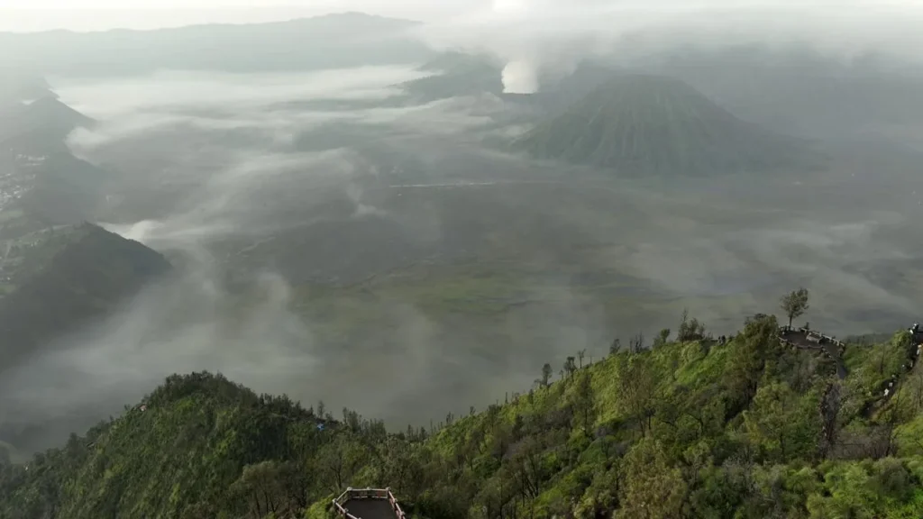
These distinct areas divide the vast Tengger Caldera into manageable, highly specialized environments for VIPs and photographers. Zone 1 provides elevated, panoramic views of the entire volcanic complex during sunrise. Meanwhile, the second area offers dramatic, wind-swept ash flats perfect for minimalist photos. Furthermore, Zone 3 contrasts the barren ash with lush, green hills for vibrant color. Finally, Zone 4 allows direct, closely monitored access to the active sulfur vents through a guided Bromo crater expedition. Dividing the trek into four sectors helps premium tours ensure maximum visual variety. In addition, it allows efficient terrain navigation. Ultimately, it evades standard tourist bottlenecks.
Zone 1: Where Is the Secret King Kong Hill Vantage Point?
The secret King Kong Hill vantage point sits about 200 meters below the primary Penanjakan 1 viewing deck. Dense alpine flora hides it along the eastern ridge of the Tengger Caldera. Most tourists flock to the paved concrete platforms above. However, exclusive Mount Bromo trekking routes redirect VIPs to this secluded ledge.
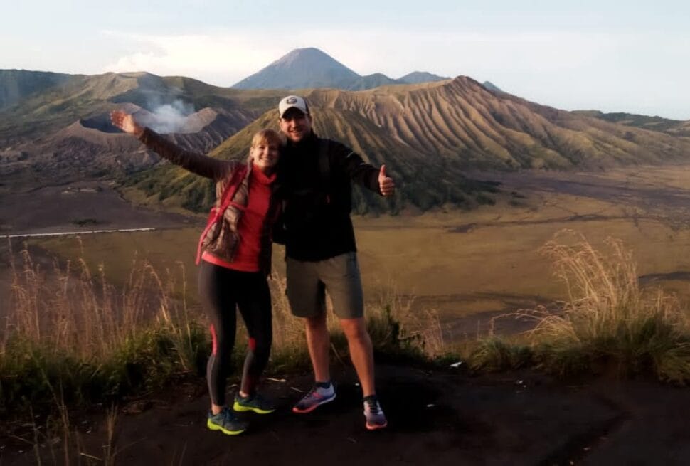
Positioning yourself at this precise elevation is critical for capturing the ultimate golden hour lighting. As the sun rises over East Java, the secret King Kong Hill coordinates align perfectly with the geological center of the caldera. This alignment allows photographers to frame Mount Bromo, Mount Batok, and the distant, erupting Mount Semeru in a single, unobstructed wide-angle shot. These three peaks are bathed in the soft, directional light of early morning. Therefore, they create incredible depth and contrast across the landscape.
Navigating to this secret ridge requires arriving by custom 4×4 under the cover of darkness, followed by an exclusive King Kong Hill sunrise trail using headlamps. The terrain here is uneven but highly rewarding, offering natural rocky foregrounds that elevate landscape composition. Unlike the crowded public platforms where tripods clash and sightlines are blocked, this isolated section of the caldera ensures absolute silence. Photographers gain spatial freedom to bracket their exposures and adjust focal lengths. Consequently, they witness the golden hour unfold across Mount Bromo without any interruptions.
Zone 2: How Do Off-Road Vehicles Navigate the Whispering Sands?
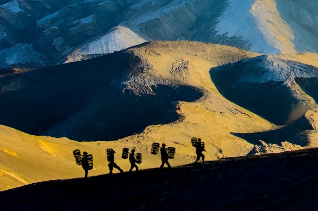
Navigating the Whispering Sands requires specialized 4×4 vehicles. These vehicles must have deflated, high-traction mud tires. Furthermore, you need seasoned local drivers who understand the shifting caldera basin. The Whispering Sands is a vast, desolate expanse of fine volcanic ash located to the east of the Mount Bromo crater. For VIP trekking expeditions, crossing this sea of sand is not merely a transit route; it is a vital photographic zone.
Standard tourist jeeps often stick to the deeply rutted, compacted tracks, driving in heavily congested convoys. Exclusive tours, however, veer off into the pristine, untouched sections of the ash flats. Drivers manipulate differential locks and utilize low-gear ratios to prevent the heavy Land Cruisers from sinking into the deep, loose pumice. This off-grid navigation guarantees that photographers reach isolated dunes where the wind naturally erases tire tracks, leaving a flawless, rippled texture on the ground.
The dust kicked up by the vehicles interacts dynamically with the morning light. As a result, it creates cinematic, diffused atmospheric conditions. These conditions are ideal for capturing dramatic silhouettes and landscape photos. Capturing a lone 4×4 vehicle against the massive, sheer walls of the Tengger Caldera offers a profound sense of scale.
Preparing for the Ash Basin Descent
Following the sunrise session, descending into this vast ash basin provides an immediate contrast. It drops travelers directly into a stark, lunar-like environment. Therefore, this area demands specialized lenses and dust-protection gear.
Read also: Bromo Hiking Routes: Ultimate Guide to Hiking Mount Bromo
When Is the Ideal Season for Mount Bromo Trekking and Photography?
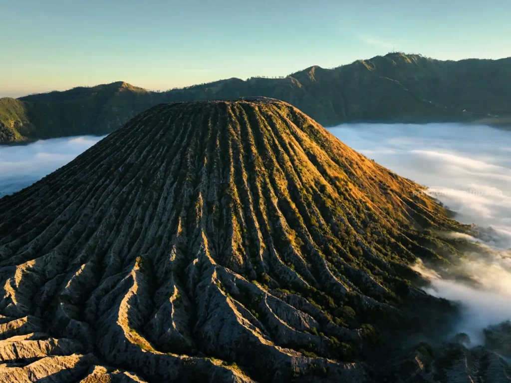
The ideal season for exclusive Mount Bromo trekking and photography is the dry season, which runs from April through October. During this window, atmospheric clarity reaches its peak, precipitation drops significantly, and the Tengger Caldera experiences highly predictable weather patterns. VIP travelers heavily favor the months of July and August, as the lower temperatures generate the iconic “sea of clouds” phenomenon within the caldera basin, a highly sought-after visual for landscape photographers during golden hour.
Trekking During the Wet Season
Conversely, the wet season presents a completely different terrain from November to March. Frequent afternoon storms and heavy morning mist make summiting the active crater lip more challenging. However, the landscape completely transforms during this time. The dry, dusty savannahs turn a vibrant, emerald green, and the volcanic ash takes on a rich, dark hue due to the moisture. This provides a striking color contrast rarely seen in standard promotional imagery. However, navigating the off-road zones requires highly advanced driving techniques, as the Whispering Sands can turn into unpredictable mud.
Below is a comparative breakdown to help you plan your premium trekking experience based on your specific visual goals:
| Feature | Dry Season (April – October) | Wet Season (November – March) |
|---|---|---|
| Topography | Arid, loose volcanic ash, dry savannah plains. | Compacted damp ash, vibrant green hills, occasional mud. |
| Lighting Conditions | High clarity, crisp golden hour, predictable sea of clouds. | Diffused light, dramatic storm clouds, moody atmosphere. |
| Gear Requirements | Dust covers, polarized filters, thermal layers for cold mornings. | Waterproof housings, lens wipes, aggressive trail boots. |
| Crowd Density | Maximum capacity (VIP routing strictly necessary). | Lower density (Easier access to primary photography ridges). |
Selecting the right season dictates the necessary camera equipment, the visual tone of your portfolio, and the logistical complexity of the trek.
Are Traditional Sunrise Viewpoints Worth the Crowds?
Thousands of tourists flock to the renowned Mount Penanjakan 1 viewpoint every morning. However, premium travelers often question this popular choice. They wonder if the packed viewing decks are truly worth the limited creative control. The prevailing narrative insists that Penanjakan 1 offers the definitive sunrise over the Tengger Caldera. However, our field analysis reveals a compelling counter-narrative. Traditional mass-tourism viewpoints inherently compromise serenity. They also limit the compositional freedom that professional photographers require. You might stand shoulder-to-shoulder with hundreds of other visitors. Consequently, securing an unobstructed foreground for your tripod becomes difficult. Attempting multi-exposure blending also becomes an exercise in frustration rather than artistic skill.
Instead of battling the relentless crowds at Penanjakan 1, VIP Mount Bromo trekking routes prioritize exclusive, less-documented vantage points. Premium routes utilize alternative paths like a hidden Mount Kursi sunrise hike, or secluded, undeveloped ledges near Seruni Point’s outer rim. These alternative coordinates deliver identical, if not vastly superior, sightlines of Mount Bromo, Mount Batok, and Mount Semeru aligning in the morning mist, entirely without the overwhelming tourist density. By circumventing the standard mass-tourism trail, premium tours grant photographers the spatial liberty to experiment with ultra-wide panoramic sweeps, uninterrupted time-lapses, and complex focus-bracketing techniques. The true luxury in East Java landscape photography is experiencing its prehistoric grandeur in complete, uninterrupted solitude, which can also be achieved through a scenic Mount Batok sunset hike.
How Should Photographers Master the Golden Hour at Mount Bromo?
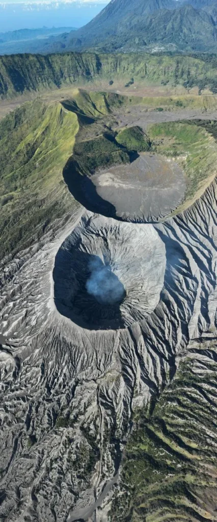
Mastering the golden hour at Mount Bromo requires more than simply arriving before dawn. It demands a tactical understanding of atmospheric optics and topographic shadow-casting. You must also understand volcanic microclimates. The Tengger Caldera possesses a unique meteorological phenomenon. Dense morning mist trapped within the immense Sea of Sand diffuses the sun’s first rays. As a result, this creates a dynamic, shifting color palette. To capture this accurately, photographers must anticipate the lighting transition. The light shifts from the cool blue hour to sudden high-contrast, directional light. The most critical photographic window starts fifteen minutes before sunrise. It lasts until forty-five minutes after dawn. During this time, the volcanic ash and grooved terrain reveal striking, multi-dimensional textures.
Positioning and exposure management are paramount. Premium trekking guides strategically place VIP clients facing the light source. This captures the iconic silhouette of the Bromo-Batok-Semeru alignment. They also calculate angles for dramatic shots of the active crater. Furthermore, exposure management during this rapid lighting shift is vital. Bracketing exposures ensures maximum dynamic range retention. This balances the bright sky with the deep caldera floor.
Managing Exposure During Your Trek
Step directly into the volcanic landscapes of East Java. You can visualize your upcoming trek by walking through our latest field video. Photographers can pre-visualize their compositions by studying the light’s interaction with sulfuric plumes. Finally, VIP photo tours provide temporal flexibility to wait out cloud cover. This ensures the golden hour yields portfolio-defining landscape imagery.
What Camera Gear Elevates High-Altitude Caldera Shots?
The optimal camera gear for high-altitude caldera photos requires a robust, weather-sealed camera. You should pair a full-frame mirrorless or DSLR body with high-quality zoom lenses. Volcanic ash, silica, and acidic sulfur dust are pervasive throughout the Mount Bromo trekking routes. Therefore, minimizing lens changes in the field is crucial. This protects your camera sensor from irreversible damage.
To significantly elevate your imagery, a fast wide-angle lens is non-negotiable. It captures the sweeping, panoramic scale of the Tengger Caldera. It also highlights the expansive, textured foregrounds. Conversely, a sharp telephoto lens is essential for compressing the visual distance. It bridges the foreground craters and the erupting Mount Semeru. Furthermore, it isolates intricate, high-contrast textures along volcanic ridges. Mastering the exposure triangle at high altitudes requires specific optical filters. A graduated neutral density filter is critical here. It balances the extreme sunrise sky against the deep crater floor shadows. Furthermore, a heavy-duty, carbon-fiber tripod is strictly mandatory for absolute stability. It secures long-exposure blue-hour shots and base-ISO focus-stacking. Consequently, it successfully counteracts high-velocity crosswinds at these high-altitude vantage points.
How Does Altitude Alter Topography During Mount Bromo Trekking?
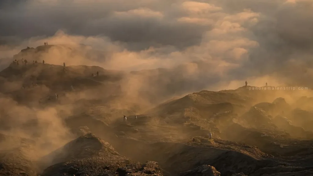
The topography of Mount Bromo trekking zones transforms dramatically as elevation increases. Therefore, it demands specialized navigation strategies and physiological awareness. Both premium travelers and private guides must prepare accordingly. The trek starts at the village of Cemoro Lawang at about 2,217 meters above sea level. Here, steep, vegetated cliff drops characterize the terrain. These drops lead directly into the Sea of Sand. Upon descending into the vast caldera floor, the elevation drops to roughly 2,100 meters. Here, the topography radically shifts to a sprawling, arid desert composed of fine volcanic ash, hardened lava flows, and loose pumice, making on-foot navigation highly abrasive and physically strenuous.
Navigating the Active Bromo Crater
The final ascent toward the active Bromo crater begins and peaks at 2,329 meters. Here, the geological composition morphs into deeply grooved volcanic scree. At this altitude, effective oxygen levels drop by about 24 percent. As a result, this accelerates muscular fatigue and alters cardiovascular demands. Navigating these elevation changes requires premium 4×4 off-road vehicles. These vehicles feature specialized suspension systems for traversing deep ash-laden plains. Afterward, you must follow measured, slow-paced hiking protocols. This effectively manages human exertion in the thinner atmosphere. Understanding these specific topographic and atmospheric shifts is essential for maintaining safety, comfort, and stamina throughout a comprehensive VIP expedition.
Frequently Asked Questions About VIP Mount Bromo Trekking
What Premium Permits Are Required for Drone Photography?
Drone photography at Mount Bromo requires specialized aviation permits issued directly by the Bromo Tengger Semeru National Park authority. Commercial drone operations strictly mandate an official Unmanned Aerial Vehicle clearance. This clearance is entirely separate from standard visitor tickets. VIP trekking packages handle this complex bureaucratic process in advance. They explicitly secure the necessary conservation zone flight permissions before arrival. Operators must fly within designated visual line-of-sight parameters. Furthermore, they must strictly avoid hovering directly over active fumaroles. This prevents corrosive sulfur gas damage to electronics and complies with aviation safety laws.
How Do Private Guides Ensure Safety Across Active Volcanic Terrain?
Private guides ensure total safety by continuously monitoring real-time seismic data and atmospheric sulfur dioxide levels provided by Indonesia’s Center for Volcanology and Geological Hazard Mitigation (PVMBG). Prior to any Mount Bromo trekking expedition, VIP guides actively assess localized wind directional models to definitively avoid toxic gas plumes venting from the active crater. Premium guides carry industrial-grade respirators and emergency oxygen supplies tailored for sudden shifts in high-altitude air quality. Additionally, professional guides use encrypted GPS devices to maintain contact with rapid emergency teams. This ensures immediate response protocols remain active. Ultimately, it keeps you safe while traversing the unstable, narrow caldera rim.
How Do You Plan the Ultimate Indonesian Photography Tour?
Planning the ultimate Indonesian photography tour demands meticulous attention to detail. You must consider seasonal lighting shifts and logistical precision. Furthermore, you need secured access to exclusive, crowd-free viewpoints. A seamless VIP Mount Bromo trekking experience requires moving beyond generic tourist itineraries. Instead, you must embrace highly customized routing. This routing aligns perfectly with your specific creative objectives. Your photographic goal might be capturing morning mists across the Whispering Sands. Alternatively, you may want to document the active caldera under golden hour illumination. In either case, expert local knowledge is the deciding factor for capturing a world-class visual portfolio. Secure your access to the region’s most coveted vantage points, specialized off-road transport, and elite professional logistical support today. Map out your perfect Indonesian photography itinerary with a free, no-obligation route consultation at Contact us here.